• Beautiful Lake Maninjau : West Sumatra Destination

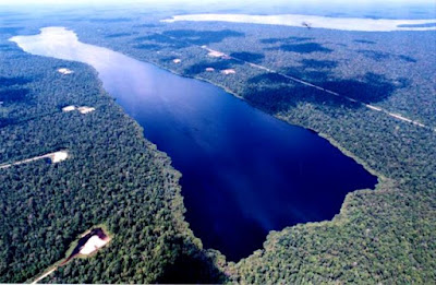
    Lake Maninjau is a volcanic lake that is located at 461,50 meter above the sea level. Its width is 99, 5 km2 with 4, 95 meter of the maximum depth. The existence of Lake Maninjau has created a folktale called "Single Sembilan" (The nine Bachelors). People living around the lake believe that those nine Bachelors are real...

  • Bantimurung Waterfall the Best Destination in South Sulawesi

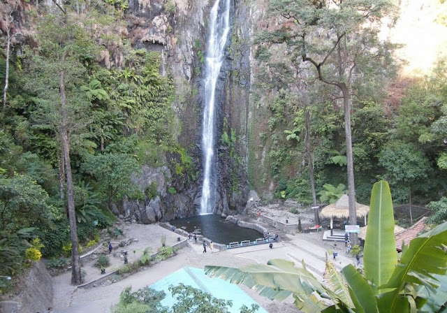
    Bantimurung waterfall (15 meters in height and 20 meters wide) is a very famous natural tourism destination in South Sulawesi. Pure water falls down from the crag every year. Beneath the waterfall, there is a bathing place made of limestone covered by mineral vein which is caused by the stream flow for hundred years....

  • Nimanga River, Best Rafting in North Sulawesi

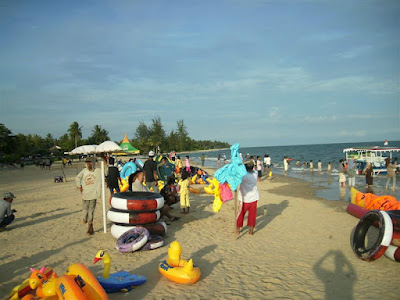
    Nimanga River is one of the most favorite tourism destinations in the North Sulawesi. It has been popular as it is used for any kind of extreme sports and other activities. It will be great experience for having an extreme sport such as rafting along the river...

Wednesday, December 12, 2001

The Museum of Balla Lompoa

 The Museum of Balla Lompoa
 The Museum of Balla Lompoa

The Museum of Balla Lompoa  is the reconstruction of Gowa palace that was built in 1936 A.D. The 31st Sultan of Gowa, I Mangngi-mangngi Daeng Matutu, was the king at that time. Balla  Lompoa means big house or grand house in Makassar  language. The precise architecture of Bugis tribe like Panggung House, with  a 2-meter high of ladder leading to the entrance of the terrace, is the main  architecture of the museum. It is made of ulin wood or besi wood.  The Museum of Balla Lompoa stands in a width of a  hectare land bound a high brick fence.

The Museum   of Balla Lompoa comprises  two parts, the main room, 60 x 40 meters wide, and the terrace, 40 x 4.5 meters  in width. There are three parts of the main room, the king’s bedroom, the historical  properties storage, and the working room. Each part is 6 x 5 meters wide. It  has many windows (The exclusive features of Bugis house) which are 0.5 x 0.5  meters in width. 

It is functioned to keep the collections of Gowa Kingdom’s  heritages. The historical properties are displayed based on the general  functions of each room in the museum. An Indonesian map is displayed on the  right wall, in front of the main room. The family tree of the Gowa Kingdom  is also displayed in the main room. It was begun from the first king of Gowa,  Tomanurunga in the 13th centuries until the last king of Gowa,  Sultan Moch Abdulkadir Aididdin A. Idjo Karaeng Lalongan (1947 A.D.-1957 A.D.).  You can find the throne of Gowa   Kingdom placed in the  center of the main room. The war equipments such as spears and old cannons are  displayed in this room. You will also find the Lalong Sipue umbrella  (The umbrella that was used when the inauguration of Gowa Kings take place) in  this room. The museum has been renovated in 1970 A.D. – 1980 A.D. The local  government of Gowa has been budgeting fund about 25 millions each year to  maintain the museum.

The Museum   of Balla Lompoa keeps  many priceless historical heritages, most of them are made of gold. In  addition, there are precious stones beautified with diamonds and the ruby stones.  There are about 140 collections of priceless historical properties such as  crown, bracelet, button, Keris. The weights of the heritages are about  700 grams up to a kilogram. There is a cone (The five leaves of lotus) king  crown beautified with 250 grams of diamonds in the king’s bedroom. The weight  of the crown is 1.768 grams. Tataparang (The golden keris) which  is 986.5 grams in weight, 51 centimeters in length and 13 centimeters wide is also  kept in this room. It was the gift of Demak Kingdom.  10 spears, seven lontara texts, and two handwriting of Al-Qur’an made in 1848  are also kept in the Museum   of Balla Lompoa.

Where Museum of Balla Lompoa Location?

The Museum of Balla Lompoa is on Sultan Hasanuddin Street 48th Sungguminasa, Somba Opu sub-district, Gowa district, South   Sulawesi province.The Museum of Balla Lompoa is located in Sungguminasa, Somba Opu  sub-district, in the district of Gowa, which is directly bordered with Makassar city. It can be reached by private vehicles or  any type of public transportation. The accommodation provided by the Museum of Balla Lompoa  is guide service telling you information relating to the museum and all of the  heritages kept within.

Thursday, November 22, 2001

Baiturahman Mosque

Baiturahman Mosque
Baiturahman Mosque

Baiturrahman Mosque is the symbol of religious life, bravery, and nationalism of Aceh people. Built on the tenure of Sultan Iskandar Muda (1607 – 1636 A.D.), the mosque was functioned as a center for religious education in Nusantara (Malay Archipelago). Many Islamic scholars and students from other countries like Arab, Turkey, India, and Persia came to gain Islamic religious education there.

The mosque is a silent witness of Aceh people’s struggle in defending Aceh from the Dutch’s occupation during 1873 to 1904 A.D. It has ever been ever ruined after being burned by the Dutch in 1873 A.D. Kohler was dead for being struck by Aceh people in the area Baiturrahman Mosque. Remembering such tragedy, a monument was built in the front-left side of the mosque under a ketapang tree. For an effort to quiet the anger of Aceh people as the mosque had been destroyed, the Dutch – by the command of Governor General Van Lansnerge – rebuilt the mosque by 1879 A.D. Up to now, the mosque has ever been refurbished for fifth times during 1879 – 1993 A.D.

The last terrible historical momment of the mosque was the tragedy of tsunami on December 24th 2004 when the fast water’s stream of tsunami was almost flooding the ground floor of the mosque. Once, the mosque becomes a silent witness for people being safe from tsunami at the time. Many people died at the tragedy were laid down inside the mosque before they were identified. Baiturrahman Mosque is one of the most grandiose mosques in the South East Asia. Situating at 4 ha area with unique architecture are some distinctions differentiate the mosque from the others. Moreover, it has seven domes, four minarets, and a main minaret. The floor of the mosque uses Italian marbles with approximately 4.760 meters square in width. The capacity of the mosque is around 9.000 people.

Baiturahman Mosque Location

Baiturrahman Mosque is located in the heart of Banda Aceh City next to the traditional market of Aceh, Nangroe Aceh Darussalam Province, Indonesia. Situating in the center of Banda Aceh City, it can make you easier for accessing the location either by taking private transports or public transports. It is easy to find either stars hotels or middle-class hotels around the location remembering its location in the heart of Banda Aceh City.

Monday, November 12, 2001

Panji Sukarame Dam

Panji Sukarame Dam
Panji Sukarame Dam

In the past, Panji Sukarame Dam was just a pond that was  dammed up then was functioned for irrigation. Its grassy fields and bushes on  its surface are bewitching scenery of the destination. It is not only used for the  irrigation but also as a worth visiting tourism destination. It is frequently  visited on Saturday, Sunday and holidays. You can look around the destination, observing the orchid  park and the magnificent view of its nature. On the side of the dam, there is a  pergola where you will feel the fresh air and the shade of the location. There  are leafy trees and various plants around the location, while you can see the Kartanegara  Ship. Besides the dam, you will see another interesting tourism destination, Museum  Kayu (The Woods Museum) around there.

How to Access Panji Sukarame Dam Location?

Panji Sukarame Dam is located in Rondong Demang village,  Tenggarong sub-district, in the district of Kutai Kartanegara, East Kalimantan province. To reach the destination, you can take either car or  motorcycle by land. The access is about 3 km from Tenggarong sub-district. The entrance ticket is Rp. 500/ person.

Monday, October 22, 2001

The Exotic Scenery of Zamrud Lake in Riau

The Exotic Scenery of Zamrud Lake in Riau
Zamrud Lake


Lake Zamrud comprises two lakes, Lake  Pulau Besarand Lake   Bawah. Since it is  located in Zamrud village, those lakes are commonly called Lake Zamrud.  On November 25th 1980, it was declared as wildlife reservation area.  Nowadays, the settlers and the local government of Riau province suggest that the  2.500 ha wide area of the lake will be functioned as National Park. The exotic scenery of  Lake   Zamrud and its fresh air can  be alternative for you looking for tranquil holiday. It combines the concept of  Ujung Kulon  National Park, in Banten province and Lake Toba with  Samosir Island  in it, in the North Sumatra. The rare species  such asGold Arwana fish (Scheleropages formasus), Balido fish, Sumatran  Tiger (Pantheratrigis sumatraensis), Red Bear (Helarctos malayanus),snakes  and the icon of Riau province, Serindit bird (Loriculus galgulus) can  be found there.  The black color of the water  in the swamp forest and oil drilling area reflect an emerald (Zamrud) portrayal,  when it is observed from the air. At evening, hawks, monkeys, even Sumatran  Tiger come out from their homes.


The Exotic Scenery of Zamrud Lake in Riau

How to Access Zamrud Lake Location?

Lake Zamrud is located in the village of Zamrud, Siak Indrapura sub-district, Siak  district, Riau provinceThe access is about 180 km away from Pekanbaru city, the capital of  Riau province. It will be less than 3 hours when the traffic is not heavy. The municipal government of Siak district would like to develop Lake Zamrud  as a worth visiting water tourism in Riau province. It will be built  playground, fishing area, and other facilities. It will be furnished with the various  species of birds and fresh water fishes like Lele Dumbo fish (catfish), Patin fish, Nila fish, and Udang Galah (lobster). There will be  programs to develop the area as the center for the research of medicine and  natural science. There will be guides explaining you the detail of the  location.  

Friday, October 19, 2001

Sedudo Waterfall

Sedudo Waterfall

Situated at an altitude of 1.438 meters with 105 meters deep water, Sedudo Waterfall is a famous tourism destination in East Java Province, Indonesia. Moreover, its location in the slope of Mount Willis, an inactive mount at an altitude of 2.552 meters, south of Nganjuk City, has enhanced this waterfall become more enchanted.

Besides enjoying the water falling down from the crag of Mount Willis which offers you a magnificent view, in the location you will also experience a cultural tourism there. People living around the location believe that Sedudo Waterfall bears many efficacies. Many people assume that taking a bath under the splashing water of Sedudo Watefall will make people stay young.

Sedudo Waterfall

On the first day in Javanese calendar, the ritual of Parna Prahista is held annually by the local government of Nganjuk District. It is a ritual of purifying a statue using the water taken from Sedudo Waterfall. At the end of the ritual, the water, which is assumed for bringing safety and ageless, is splashed onto the attendants. Regarding the location in the slope of Mount Willis, you will see a panoramic view of surrounding area.

Sedudo Waterfall Location

Sedudo Waterfall can be found in Ngliman Village, Sawahan Sub-district, Nganjuk District, East Java Province, Indonesia.Sedudo Waterfall can be found in Ngliman Village, Sawahan Sub-district, Nganjuk District, East Java Province, Indonesia. When you take a trip from Surabaya to the location in Nganjuk District, it is around 110 km away. It will be more or less 200 km away when you depart from Yogyakarta Province to the location. You can take any accessible public transportation to reach the location via both cities.

It is about 30 km southern direction to the capital of Nganjuk District passing by hilly-winding road. Considering such access, it is better for you to take private car rather than public transportations like bus. Entering Sedudo Waterfall, you need to pay IDR 2.500 of the entrance ticket. For you who want to spend more days in the location, there are some inns or hotels there. Moreover, you can also find many fruit sellers there. 

Thursday, September 20, 2001

Suhom Waterfall

Suhom Waterfall
Suhom Waterfall


Nowadays – after the political conflict occuring in Aceh was over – Suhom Waterfall is frequently visited by tourists coming either local or international. The situation was different when the political concflict occurred in Aceh. It was rarely visited by tourists. For you who want to know more about the waterfall and surrounding area, you will be accompanied and guided by the local inhabitants during the visit.

It is situated in the middle of a forest offering the maginificent view of surrounding area. It is encircled by durian trees (Durio zibethinus), so it is likewise famous for numerous people selling durians during the harvest time of durians. Campground located next by the waterfall is a right place for you who want to experience the sensation of spending night in the location while enjoying the beauty and the magnificent of the nature.

The water flowing from the waterfall is functioned as the electricity generator in Krueng Kala Village. It is operated to distribute the electricity power to 200 families in Krueng Kala Village.

During the journey to the location from banda Aceh City, you will be offered the wonderful panoramic view of the pounding wave along the seaside. Moreover, mountanious areas standing in a row along the road is a distinction from other destinations that can only be found in the location.

Suhom Waterfall Location

Suhom Waterfall lies in Suhom Village and Krueng Kala Village, Lhoong Sub-district,  Aceh Besar District, Nangroe Aceh Darussalam Province, Indonesia. To reach the location, it will spend approximately an hour by public transportation via the route Banda Aceh – Calang (Aceh Jaya) passing by Lampuuk Beach, Lhoknga Beach and Leupung Sub-district. There is no lodgement or inn around the location. Therefore, you must carefully consider for spending night there. However, you can spend the night there by building tents around the location which has a right place for camping.

Monday, September 17, 2001

Wonderful of Manggar Segarasari Beach in Balikpapan

Wonderful of Manggar Segarasari Beach in Balikpapan
Manggar Segarasari Beach


The Manggar Segarasari Beach  is a worth visiting tourism destination in Balikpapan,  East Kalimantan province, Indonesia.  Clear water and white grain sand offer you a panoramic view for a tranquil  holiday. The entire extent of the destination is around 13 km squares.

As the Manggar   Segarasari Beach  has a wide area, you can do activities to kill the time of your holiday while  enjoying the pounding waves that is not too high. Playing football, flying  kites, swimming, and having an adventure by the rubber canoes can be  alternative activities for you. It is opened for public at 6 a.m. until 6 p.m.

How to Access Manggar Segasari Beach Location?

The Manggar Segarasari Beach  lies amid the villageof Manggarand the villageof Teritip, East Balikpapan sub-district, Balikpapan City, East Kalimantan province.To reach the destination, you may use either motorcycle or  car. The access is about 22 km from Balikpapan, and  9 km eastwards from Sepinggan   Airport. Besides using  your own private transportation, or the number seven way of public  transportations, as alternatives for you.  The Manggar Segarasari Beach has been provided with parking  area, information room, shelter, placard direction, food tents and stalls  (usually offer you Bakso (Meatball), Young Coconut Ice, Gado-gado, etc),  rest room, and others. You may hire rubber canoes (about Rp. 5.000 to Rp.  10.000), balls (about Rp. 10.000), or rubber canoes for two people (about Rp.  15.000) and swimsuits.  

Friday, August 17, 2001

Rencong, Traditional Weapon from Aceh

Rencong, Traditional Weapon from Aceh
Rencong

Rencong is a traditional weapon from Aceh that is made of white metal, brass alloy, and horn of buffalo (white or black). During the colonialism of the Dutch, rencong was used either by men or women in the battle field to battle the Dutch. Rencong is slipped into the scabbard and worn on the left hand side of the stomach directed to the right hand. The way of wearing rencong depicts the egalitarianism, social status, and is also the symbols of self defense, bravery, and heroism in fighting the Dutch.  Noted that some great heroes coming from Aceh such as Cut Nyak Dien, Cut Meutia, Pocut Meurah Intan, Pocut Baren and Tengku Fakinah used rencong to fight against the Dutch. They were the silent witnesses of Aceh people‘s bravery in efforts to defend Indonesia, especially Aceh Province from the occupation of the Dutch colonial government.

Nowadays, rencong is a souvenir from Aceh Province. That is why, we suggest you to buy rencong as your souvenir when visiting Aceh Province.

One of the distinctive features of rencong is on its making process. The making process of rencong using white metal as the basic material is rather difficult than using brass alloy. There are four types of rencong in Aceh Province; pudoi, which has not had perfect shape yet on its handle; meukure, decorated with various motifs such as animal, flower, and root; meupocuk, having gold filigree at the upper end of the handle; and meucugek which is on its handle glued something called cugek (a glue and 90 degree of angle).

The Islamic philosophies of rencong are on its handle engraved ba letter (Arabic scripts), as well as on the base of the handle, sin letter. On the bottom of the blade is mim letter while lam letter is along the blade. Those Arabic letters on rencong sound basmalah (in the name of Allah).

Where Find Rencong Home Industry Location

You can find the center of rencong home industries in Baet Masjid Village, Baet Meuseugoe Village, and Baet Lampu ot Village. Those are in the sub-district of Sibreh, Aceh Besar District, Nangroe Aceh Darussalam Province. It is about 25 km away to reach those three villages from Banda Aceh City by any public transportation for approximately 45 minutes. 

Rencong, Traditional Weapon from Aceh
Rencong Industry

The price of a rencong depends on its quality, including the material of the blade and the handle and its size as well. For a medium rencong (10-12 cm long) made of brassalloy, the prices range from IDR 20.000 to IDR 75.000. A bigger rencong, more than 12 cm long, vary in price from IDR 75.000 to IDR 80.000. The highest price of rencong is rencong made of white metal as the basic material. Fur currently, there is no guesthouse around those three villages. However, you can observe in more detail its making process. Moreover, you can order a rencong based on what you want. You can choose every material for your Rencong starting from choosing the horn and the material for the blade. Almost all the rencong makers are men. Their knowledge in the making of rencong is inherited from their parents. rencong made by those three villages are distributed to several districts in Aceh Province, especially in the traditional market in Banda Aceh City.


Wednesday, August 15, 2001

Visiting Mayura Water Park in Lombok Island

    Visiting Mayura Water Park in Lombok Island
    Mayura Water

    Visiting West Nusa Tenggara province will not be complete  before visiting Mayura Water Park.  It is a unique and special water park; the combination of park and the concepts  of pond and shrine which are fully decorated by the motives of Balinese,  Javanese and Lombok, will amaze you visiting  the location. It was built in the era of Bali  Kingdom when they held the power in Lombok Island  by A.A. Made Ngurah Karangasem king in 1744 A.D. It was called KelepugPalace, derived from Kelepug (The  sound of swift water stream from the spring in the centre of the pond).
    In the era of Mataram   Kingdom, it had been  renovated under the decree of A.A. Ngurah Karangasem King in 1866 A.D. Not only  physical building that was changed, but also its name that was turned into Mayura.  Mayura, derived from Sanskritmeans peacock. Once upon a time, in  the era of A.A. Ngurah Karangasem King, there were snakes in the palace  disturbing the activities in the palace. Therefore, a counselor suggested that  the palace had to breed peacocks in order to chase away the snakes. Its  strategic location and the historical values cause the location is visited by  tourists either local or foreign tourists.


    The Mayura   Water Park  offers you the combination of natural, religious, and historical nuances.  Tranquil felling is the first impression when you enter the location. There is  a pond which is neatly organized to improve the natural nuance of the location.  In the center of the pond, there is a small building called “Bale kambang” or Gili (in local language means small islands). You will see many mangosteen  trees planted in a line. You may pick the fruits if the guides permit you.
    Some buildings in Balinese motive combined with the  influence of Javanese and Lombok   Island shape up a religious  nuance in the location. Based on the guides` explanation, the main spot of the  location is a shrine located in the upstream of the pond. However, visitors  often miss the shrine since the location, the size of the pond that are too  wide, and the leafy mangosteen trees. Its name isKelepug, which is  meant to remind the earliest name of the location. At some rituals, the temple  is functioned as worship place.
    There will be some guides explaining the history of Mayura Water   Park. One of the interesting  stories about its history is a statue having a western Asian face. It was a  gratitude to a western Asian person for his idea to breed some peacock to chase  the snakes in the palace. In addition, Bale Kambang was built because of  the inhabitants` pressure for justice. The trial process was held in the Bale  Kambang in the era of Rad Kerta. There will be more information about its  history and amazing concepts of the building.

    Where to Access Mayura Water Park Location?

    Mayura Water Park is located in a business center, Cakranegara sub-district, Mataram city, West  Nusa Tenggara province. It will be 15 minutes from Narmada  bus station. It can be accessed by public transportation about Rp. 5.000 in  cost or you may get taxi which cost is about Rp. 15.000. You can also start the  trip from Mataram for about 10 minutes with Rp. 2.500 in cost by public transportation  or Rp. 10.000 by taxi. The entrance ticket includes the guides` services. They will  tell you about the concept and the history of the location. They will invite  you look around the location in approximately 15 minutes, after that, they will  allow you to take an observation alone.

    There are hotels and restaurants nearby this historical  tourism destination. Considering that the location is a business centre, you  will find food tents and stalls offering the ethnic cuisines of Lombok Island  like Pelecing.

The Exotic Panorama on Matras Beach, Bangka Belitung Island

The Exotic Panorama on Matras Beach, Bangka Belitung Island
 Matras Beach

Matras Beach is a beautiful and sloping sandy beach where the white grain sands spreads out like pearls offering the splendid view of its nature. It is 2 km in length with around 20 to 30 meters wide where some leafy coconut trees welcome you. The white sands combined with the wonderful coastal rocks and the water flowing from the river to the sea are stunning sceneries for your tranquil holiday. Therefore, it is commonly called “Pantai Surga” (The beach of the heaven). It is the most popular one among the other beaches inBangka-Belitung Province that is frequently visited by tourists either domestics or foreign.


The white grain sands, the leafy coconut trees, and the natural water flowing from the river are some distinctive features of the location that will be hard to be found in other destinations. Its comfort and the ease offer you an unforgettable holiday while enjoying your meals leaning on the wonderful coastal rocks.


How to Access Matras Beach Location?


Matras Beach lies in Sinar Jaya VillageSungailiat Sub-district, Bangka District, Bangka-Belitung Province. It is the northeast of BangkaIsland, about 40 km from Pangkal Pinang or 7 km from Sungailiat. Taxi or private cars are recommended transportations for you who want to reach the destination. You may start the trip from Sungailiat or Pangkal Pinang. It is approximately an hour from Pangkal Pinang passing by winding road.

There are many airlines that serve the airport for flights to Depati Amir Pangkalpinang such as Garuda, Lion Air, Batavia Air, Sriwijaya Air and others. To arrive at this beach, visitors can use various types of vehicles that can be rented in Depati Amir. If you want to use public transportation, from Pangkalpinang the visitors can take Colt, majoring Pangkalpinang-Sungailiat with cost Rp. 6.000, -.

Friday, July 20, 2001

Takengon City

Takengon City
Takengon City

Located in the highland of Gayo, Takengon City is a worth visiting tourism destination in Aceh Province. It is a city with a panoramic view of its nature in the center of Aceh Province. Lake Laut Tawar, one of the famous tourism destinations in Aceh Province is located in Takengon City likewise.

Many tourists, either domestic or local, come to Takengon City to visit and to spend some nights there around Lake Laut Tawar. Besides, Takengon City also offers you other tourism destinations such as Puteri Pukes Cave, Pantang Terong, Wih Pesam Hot Spring, Terong Hill (Khafi Peak), Loyang Karo Cave, Menye Beach, Ketibung Beach, and the Monument of Pacuan Kuda (horse race). The last one is held in a different way. The jockeys are naturally well-trained children, so they seem amazingly brave to participate in the horse race without using saddle. At least there are 20 tourism destinations in Takengon City, so many choices for you for having tourism there.

The indigenous people of Takengon City come from Gayo tribe that is the offsprings of Batak Karo from North Sumatra. Moreover, the mother tongue of the inhabitants is also different from Aceh people‘s mother tongue.

Dealing with its locaton in the highland of Gayo, Takengon City is famous as a city which has fresh air and maginificent view of surrouding area. Gayo Coffee as the main commodity of Takengon City, has been exported to Japan, USA, and Europe. The other export commodities are tomato, markisa, vegetable, corn, chili, potato, tangerine, avocado, and tobacco.

Takengon City Location

Takengon City is the capital of Central Aceh District, Nangroe Aceh Darussalam Province.Takengon City is the capital of Central Aceh District, Nangroe Aceh Darussalam Province. You can easily access Takengon City from Bireun City, where you can find a small bus station. You can take a type of public transportation that will carry you directly to Takengon City with IDR 25.000 for its costs (January 2008). It is approximately five hours to reach the location from Bireun City. Moreover, you can also reach the location from Blang Kejeren or Kutacane. As an additional information, Bireun City is the capital of Bireun District, Nangroe Aceh Darussalam Province, Indonesia. Remembering that Takengon City is the capital of Central Aceh District, you can easily find some middle-class hotels as well as stars hotels. Nearby the cave tourisms, there are some speedboat rentals with reasonable prices for you who want to enjoy the magnificent view of Lake Laut Tawar.

Monday, July 9, 2001

Hiking and Trekking Mount Rinjani - Lombok Island


The term Rinjani  comes from the old Javanese word which means Majesty. Based on the tale of  Sasak tribe, this is a residence of princess Anjani, the daughter of the  highest deity in Lombok   Island. It was declared  as National Park by the Forestry Minister in 1990. With 41.330 ha in width and  3.726 meters above the sea level, it is considered as the third number of the  highest mounts in Indonesia.  It has tropical climate with 2.066 mm/year of the average amount of rainfall.

Winding, steep and  sheer access to the peak of the mountain will be distinctive challenges for you  who love trekking and enjoying the awesome scenery of its nature. Unstable  temperature will also offer you a thrill holiday that will be hard to be  forgotten. There is a lake  named Segara Anak (about 156 ha in width) in the peak where most of people  around the mount visit it every year to celebrate a customary ceremony. 

It is  totally magnificent scenery where you can find the colorful water of the lake  in 2008 meters above the sea level. In addition, you  can also enjoy the amazing view of the lake and the whole parts of Lombok Island  on a bright weather from the peak of the mountain. Two waterfalls  located in Otak Kotok Gading and Sendang Gile village are mostly visited by  tourists especially on holiday.


Geographically, it  lies in three districts, Central Lombok district, West Lombok district and East Lombok district, Nusa Tenggara Barat province.


How to Access go to Mount Rinjani?

There are three  ways that can be accessed to reach Mount   Rinjani, Sembalun way,  Senaru way, and Torean.


  • By Sembalun way:  starting from Mataram city to Sembalun, East Lombok District (about 4 to 5  hours by any public transportation continued to the peak by walk about 7 hours.
  • By Senaru way:  from Mataram city to Senaru, Central Lombok District, about 3 to 4 hours by any  public transportation continued by walk to the peak for approximately 9 to 10  hours.
  • By Torean way:  starting from Mataram city to Torean, West Lombok District, in 4 to 5 hours by  any public transportation continued by walk for about 8  to 9 hours.


  • Wednesday, June 20, 2001

    Lake Laut Tawar

    Lake Laut Tawar
    Lake Laut Tawar

    The existence of Lake Laut Tawar among the Aceh people is a proud for them regarding that it is a frequently visited destination either by local or foreign tourists. The water is not only used by people living in Central Aceh District, but also people who live in other surrounding districts.

    There is a story relating to the existence of depik fish having slim shape and shiny scale that live in Lake Laut Tawar. People believe that depik fish is a grain of unhusked paddy that was thrown to the lake then later on shaped a fish. Depik fish appears to the lake‘s surface on certain occasions, especially on rainy season. Before the coming of rainy season, the fish hides in the slope of Bur Kelieten Mount, south of the lake. Depik is a miracle for Gayo people regarding that it will not be over though consumed forever and ever.

    Lake Laut Tawar

    Two hills flanking the lake are the magnificent scenery enhancing the beauty of the lake. The meeting of the land and the water is the livehood resources for people living around the location, especially Gayo people. It is called laut (literally means sea) since the lake is as wide as a sea and called tawar (freshwater) as the water is not salty. Depik fish is the only species of fish that can only be found in Lake Laut Tawar.

    In the lcoation you can see daily activities of surrounding people such as cultivating and fishing. Gayo coffee (Arabica Coffee) is the main comodity of surrounding people, especially Gayo. This kind of coffee is exported to Japan, as well as other comodities such as potato, passion fruit (Passiflora edulis), tomato, chili, corn, avocado and vegetable.

    Lake Laut Tawar Location

    Lake Laut Tawar (5.472 ha in width, 17 km in length, and 5,5 km square) lies east of Takengon City in the highland of Gayo (at an altitude of 1.250 meters), Laut Tawar Sub-district, Nangroe Aceh Darussalam Province, Indonesia. Accessing Takengon City, you will pass by Bireun City by taking public transportations. It is around 5 hours with more and less IDR 25000 for the cost. The another alternative way to Takengon City is via Blang Kejeren and Kutacane. There is a motorized boat that will carry you for hanging around the lake. Some inns are also available for you who want to spend more days in the location.

    Tuesday, June 19, 2001

    The Museum of Dewantara Kirti Griya

      The Museum of Dewantara Kirti Griya
      The Museum of Dewantara Kirti Griya

      Trying to preserve the remain traces of Ki Hajar Dewantara‘s life and struggle, in 1970, a museum namely Dewantara Kirti Griya was built by a Dutch scholar. The museum of Dewantara Kirti Griya keeps so much information about Ki Hajar Dewantara and his life circle, starting from his birth until his death. Dewantara Kirti Griya means a place to preserve and keep the work arts of Ki Hajar Dewantara.
      Soewardi Soerjaningrat was the full name of Ki Hajar Dewantara. Born among the palace family, Ki Hajar Dewantara, later on was conferred title Raden Mas. Then he put his honorary title, changed his name to Ki Hajar Dewantara. Putting his honorary title, he set a group consisting of Dr. Douwes Dekker and dr. Tjipto Mangoenkoesoemo that was intended to fight the colonialism in Indonesia.
      One of his contributions is the founding of educational institution namely National Onderwijs Instituut Tamansiswa concerning with the efforts to set Indonesian people free from stupidity. “When stupidity covers a country, there will be the easiest way to conquer the country, like what has been done by the Dutch colonial government over Indonesia for about 350 years,” he said. In the early years of its founding, in the 20th century, Tamansiswa had broadened to Java, Sumatra and Bali.
      Now, Ki Hajar Dewantara is recognized as the Father of Indonesia Education. On every May 2nd, most of Indonesian education institutions hold the commemoration for remembering his contributions, especially on education. 

      Reading a biography in shape of books will be bored for some people. Therefore, the Museum of Dewantara Kirti Griya applies different approach. It offers you a biography of Ki Hajar Dewantara, not in text or book shape but in shape of diorama.You will be amazed visiting this museum for its numerous collections of Ki Hajar Dewantara‘s properties. Those collections are neatly organized on the teak racks. Some of his monumental works, “Ais Ik eens Nederlander Was” (If I were Dutch) and “Een voor Allen maar Ook Allen voor Een” (One for all, all for one), can be found in the gallery room. Moreover, another one of his great works is Sari Swara, a Javanese musical notes (gamelan) that has been converted into modern musical score, can also be found there.

      In comparison to western museums, you might not be amazed with the architecture of the museum, considering that in the past it was Ki Hajar Dewantara‘s house. However, you will discover so much information relating to Ki hajar Dewantara such as his works, the  obstacles he met during his efforts to educate Indonesian people and many more. The museum also offers you with a library, special for you who want to know more about the figure of Ki Hajar Dewantara. The other benefits you will get during the visit to the museum are that you will find the biological museum of Universitas Gadjah Mada(Gadjah Mada University), the museum and monument of General Sudirman and the Museum/ palace of Puro Paku Alaman. On certain times, you will see the elementary student of Tamansiswa practice traditional dance and play karawitan (gamelan music).

      How to Access Location Museum of Dewantara Kirti Griya?

      The museum of Dewantara Kirti Griya, which is owned by Persatuan Perguruan Tamansiswa Foundation, lies in the complex of Tamansiswa, on Tamansiswa Street No. 31stYogyakarta CityYogyakarta ProvinceIndonesiaFor you who want to visit the museum, just take the city bus number three, or you may also take pedicabs, andong, or taxi. The cost for taking city bus is IDR 2.000 and it will be IDR 10.000 when you decide to take andong or pedicabs from Malioboro Street. The museum is opened for public everyday, from 8 a.m. until 4 p.m.
      You will be offered with guides‘ services. For you who want to spend more days around the location, you can find some lodgements or hotels around the destination. When the night comes, you can find numerous food tents along the street nearby the location.

    Tuesday, May 29, 2001

    Dragon Boat Race Competition in Padang City, West Sumatra

    Dragon Boat Race Competition in Padang City, West Sumatra
    Dragon Boat Race Competition

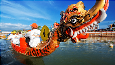
    Boat race competition in Padang City has been started since the Dutch colonial government occupied Indonesia. At the time, it was called Selaju sampan (literally means paddling boat). The boats are decorated with colourful ornaments so the paddling boats in the competition will be more attractive. In 1995, Chinese people brought Dragon Boat race Competition around the world including Indonesia. Later on, its development in Indonesia occurs rapidly rather than other countries. Hitherto, Dragon Boat Race Competition is functioned by some regions having rivers on it, as annual event, national or international, by International Dragon Boat Foundation. In PadangWest SumatraProvince, Dragon Boat Race Competition takes place to commemorate the birthday of Padang City, on August 7th. Recently, Dragon Boat Race Competition takes place at international level.

    Dragon Boat Race Competition that takes place in Padang has some distinctions from other similar events in other provinces in Indonesia. Rivers in Padang tend to have broad side, calm water and constant stream. That is why; it is regarded as the right place for such event remembering its comfort offering challenges for the players to achieve the best results.


    This competition has some categories, 200 meters race, 250 meters race, 1000 meters race and 2000 meters race. For each team, there are three classes, 10 paddlers, 20 paddlers or 30 paddlers each team. Dragon Boat Competition in Padang will be more interesting when the home team joins the competition. In 2006, when the competition of Dragon Boat took place in Malaysia and in 2007 in China, the Dragon Boat team from PadangIndonesia won the race.


    When Time of Events Dragon Boat Race Competition?

    Dragon Boat Race Competition in Padang usually takes place in Sporthall of Haji Agus alim, Padang CityWest Sumatra Province,Indonesia. The event is commonly held on August. The location can be accessed by any kind of public transportation via Ketaping Airport – Padang City route. It is around 30 minutes fromKetaping Airport to Padang CityFor you who want to spend more days around the location, you can easily find some comfortable lodgements and inns. For food and beverages, Rumah Masakan Padang are always there for you 24 hours.

    Tuesday, May 22, 2001

    Samalona Island

    Samalona Island
    Samolana Island

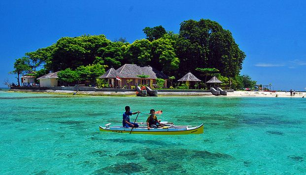
    Samalona Island is a cluster of coral reefs area with 2,34 ha in width. This small island is a favourite destination for local and international tourists. There are some activities you can do there like sunbathing above the sandy beach and diving into the deep waters of Samalona Island to observe the wonderful coral reefs and beautiful sub-marine life within. The best months for visiting Samalona Island range from February to October.

    This pleasant recreational area contains so much mysteries dealing with some wreck ships, the remnants of the world war II. At least there are seven ships that were sank there. They are Maru Boat, a Japanese warship that is approximately located at 30 meters deep; Japanese gunboat; Hakko Maru cargo vessel made of the Dutch; and Japanese submarine hunter. Now, they have turned into wonderful coral reefs where ample fishes live within. Such wonderful scenery of submarine life surrounding Samalona Island is a distinction from other destinations. Many come to the location for diving in purpose to observe some wreck ships inside the surrounding waters of the island.

    Samalona Island


    Besides revealing the mysteries within and observing the wonderful submarine life in Samalona Island, you can watch the sunrise and likewise the sunset on the same position.  There are numerous kinds of local seafood cooked with special recipe and method. For instance, fishes are cooked by putting them above coconut shell covered by some leaves growing around the location. By such cuisine, the appetizing aroma wafting from the coconut shell will lure you to taste it soon.

    Samolana Island Location

    Samalona Island is administratively included into  Ujung Pandang Sub-district,  Makassar City, South Sulawesi Province. The location is 6,8 km away from Makassar City. It can be reached for approximately 20 – 30 minutes by taking speedboat for maximum 12 people. Its costs range from IDR 250.000 to IDR 350.000. 

    In the location, there is a middle-class guesthouse for 20 people. Its costs range from IDR 150.000 to IDR 250.000. Some food tents offering fresh seafoods can be found as well. Its costs around IDR 15.000 to IDR 20.000 each portion.

    Tuesday, April 17, 2001

    The Traditional Ceremony of Garebeg Keraton Yogyakarta

      The Traditional Ceremony of Garebeg Keraton Yogyakarta
      The Traditional Ceremony of Garebeg

      Garebeg Keraton Yogyakarta is a traditional ceremony performed as a manifestation of Sultan’s duty to spread and protect Islam. The ceremony, better known as Grebeg, was initiated by Sri Sultan Hamengkubuwono I (1755 – 1792).
      The name Garebeg itself is derived from the process of miyos, the moment when the Sultan and the rest of the royal family come out of the palace (keraton) to bestow the gunungan (a heap of various food served in cone shape) to the people. The sound of the royal family’s steps is likened to the sound of a strong wind garebeg… garebeg… garebeg…
      Garebeg is held three times a year on Islamic holidays. There are three kinds of Garebeg, namely Syawal, Garebeg Maulud, and Garebeg Besar. Garebeg Syawal is performed as a form of Keraton’s gratitude to God after finishing the month of fasting and also to welcome the month of Shawwal. Garebeg Maulud is perfomed as a celebration and commemoration of the birth of Prophet Muhammad SAW while Garebeg Besar is to celebrate Eid al-Adha which takes place in the month of Dhu al-Hijja which in Javanese calendar is known as Bulan Besar (the Big Month).

      The traditional ceremony is opened with a parade of Keraton soldiers. In the structure of Keraton military, there are ten groups of soldiers: Wirobrojo, Daheng, Patangpuluh, Jagakarya, Prawirotama, Ketanggung, Mantrijero, Nyutra, Bugis, and Surakarsa. One by one, eight groups of soldiers come out of Siti Hinggil (the main hall of the palace where a Sultan is inaugurated) through Pagelaran (the front room right behind the north gate of the palace) and stop at Alun-alun Utara (the North Esplanade) to form their typical marching formation. Each personel is wearing full dress, carrying a special weapon or banner, while playing a musical instrument. After the eight groups, there will appear Manggala Yugha (Keraton’s military commanders). At last,  the gunungan is carried out of Siti Hinggil escorted by the other two groups of soldiers.

      The Traditional Ceremony of Garebeg Keraton Yogyakarta

      A gunungan is a heap of food that is served in cone shape. It is the special feature of Garebeg. It consists of various natural products, symbolizing Keraton Yogyakarta’s prosperity, that in the occasion will be provided for the people. In Garebeg ceremony, there are six kinds of gunungan, each has different shapes and consists of different kinds of food. Gunungan Dharat is a gunungan whose peak is made of dark big flat cakes and surrounded by ilat-ilatan, the tongue-like cake made of sticky rice. Gunungan Gepak is a gunungan composed of forty baskets containing various tiny cakes of five colors, red, blue, yellow, green, and black. Gunungan Kutug/Bromo contains miscellaneous cakes with a hole on its peak in which there is a brazier burning incenses. As for Gunungan Lanang, the peak is embedded with a cake made of pulverized rice called mustaka (head). This gunungan consists of a combination of long beans, red chilies, duck eggs, and sticky rice. Gunungan Wadon is a gunungan made of many kinds of small cakes and sticky rice cakes. Gunungan Pawuhan resemblesGunungan Wadon in shape, except that there is a small white flag on its peak.

      All gunungans are brought to Alun-alun Utara. By then, Keraton’s soldiers are already waiting in lines to give salvos of honors. After that, escorted by all of the soldiers, the gunungans are carried to Masjid Gedhe Kauman (Keraton’s mosque, literally means the Big Mosque of Kauman since it is situated in Kauman neighborhood) in order to be prayed for by the high priest of the mosque. Later on, the gunungans are put on the ground so that the people waiting around the mosque can take the food right away. The crowd will struggle to take any food provided in the gunungans. They believe that the food will bring them luck and prosperity. Some kinds of the food are believed to have the power to fertilize land if planted, so that the amount of crops will be abundant.

      How to Access Location Garebeg Keraton Yogyakarta?

      The entire ceremony is held in three different places, yet near to each other. The ceremony begins in the Pagelaran Hall of Keraton Yogyakarta, than moves to Alun-alun Utara and ends in the complex of Masjid Gedhe Kauman. All of the places lie in Yogyakartadowntown, the Province of Special Region of Yogyakarta, Indonesia. To get to the palace, you can take a Trans-Jogja bus route 1B, 2A, 2B, and 3A from the nearest shelter and pay around Rp. 3.000,00 (by October 2008) for the fare. Using this public transportation, you should stop at the Kantor Pos Besar shelter, then take a walk or a pedicab to the palace complex. To get more comfort and ease, you can take a taxi up to the front of the ticket counters.

      To enter the palace and see the entire ceremony, the charge is Rp 10.000,00 a person (by October 2008). Around the palace there are parking lots for motorcycle and car so that visitors who take their own vehicles should not worry. Besides, outside the gate, visitors can easily find people selling traditional toys, souvenirs, and snacks and beverages.