• Beautiful Lake Maninjau : West Sumatra Destination

    Lake Maninjau is a volcanic lake that is located at 461,50 meter above the sea level. Its width is 99, 5 km2 with 4, 95 meter of the maximum depth. The existence of Lake Maninjau has created a folktale called "Single Sembilan" (The nine Bachelors). People living around the lake believe that those nine Bachelors are real...

  • Bantimurung Waterfall the Best Destination in South Sulawesi

    Bantimurung waterfall (15 meters in height and 20 meters wide) is a very famous natural tourism destination in South Sulawesi. Pure water falls down from the crag every year. Beneath the waterfall, there is a bathing place made of limestone covered by mineral vein which is caused by the stream flow for hundred years....

  • Nimanga River, Best Rafting in North Sulawesi

    Nimanga River is one of the most favorite tourism destinations in the North Sulawesi. It has been popular as it is used for any kind of extreme sports and other activities. It will be great experience for having an extreme sport such as rafting along the river...

Showing posts with label Mountain. Show all posts

Wednesday, February 9, 2005

Mount Slamet

Mount Slamet

Mount Slamet – 3.432 meters above the sea level – is the highest volcanic mount in Central Java, and second highest mount in Java Island. The area of Mount Slamet comprises four forest areas, which are Montane Forest, Hilly Dipterocarp Forest, Ericeous Forest (mountainous forest), and Upper Dipterocarp Forest.

Mount Slamet offers distinguishing mountainous escapade with meandering and challenging track leading to the peak of the mount. You will find no water spring along the track, unless you choose Bambangan track.

Mount Slamet


On the slope of the mount, you can find several other interesting tourism destinations such as Batu Raden and Guci hot water spring. Those areas encompass some other tourism objects like botanical garden, Curug Gede, Pencuran Pitu, PAncuran Telu, Wana Wisata, Telaga Sunyi, and Kaloka Widya Mandala Park.

Mount Slamet Location

Situated at 7º14,30‘ southern latitude and 109º 12,30‘ eastern longitude, Mount Slamet lies northwest of Purbalingga City, approximately 30 kilometres. The entire area of the mount is administratively located in five districts which are Banyumas, Pemalang, Banjarnegara, Brebes, and Purbalingga districts.

Mount Slamet


You can start Mount Slamet escapade tour from Grumbul Alur Bambangan in Kutabawa Village, Karangeja Sub-district, Purbalingga District. To reach Purbalingga you can take any public transport from Purwokerto to Blambangan passing by Bobotsari before succeeding to Penjangan Village. Since arriving at Penjangan Village, you have to continue the trip leading to Blambangan by walk for approximately an hour.

Post for climbers is located in Blambangan Village. Climbers from the entire world usually gather in this post to plan the best route for climbing. In common, the journey to the peak of the mount usually spends about six hours. And please do not hesitate to ask for guidance from surrounding local inhabitants for detail information about the area around the mount.

As an alternative climbing track, you can choose a route from Mount Malang in Serang Village and Batu Raden route as well. Along the way leading to the peak of Mount Slamet, you can find some posts for taking a rest. Those posts are listed below:
  • Mount Malang–Pondok Gembiring (1 km)
  • Pondok Gembiring–Pondok Walang (0,5 km)
  • Pondok Walang–Pondok Cemara (0,5 km)
  • Pondok Cemara–Samarantu (1,5 km)
  • Samarantu–Sampang Rangkah (0,75 km)
  • Sampang Rangkah–Sampang Ketebon (0,6 km)
  • Sampang ketebon–Batur (0,9 km)
  • Batur–Sampang Jampang (0,3 km)
  • Sampang Jampang–Sampang Kredit (0,6 km)
  • Sampang Kredit–Plawangan (0,5 km)
  • Plawangan–Puncak (1 km, through Slamet Cave)
There is a post in Grumbul Alur, Blambangan, that was built for those who want to take a rest during the journey to the highest point in Central Java, Mount Slamet. Some guides are ready to tell the detail information about the surrounding area of the mount. If you want to stay more days in the mount, you may erect camp after permission from staffers of Mount Slamet Management.

Tuesday, August 17, 2004

Mount Binaiya

Mount Binaiya

Mount Binaiya is the highest mount in Maluku Province. The area of the mount ranges from Seram Island to Manusela National Park (189.000 ha). The rainfall average of the mount is 2.000 mm/year during November to April.

Mount Binaiya

In 1972, Manusela National Park was divided into two areas: Wae Mual (17.500 ha) and Wae Nua (20.000 ha). Wae Mual comprises lowland forestry area in the north. Mangrove, resin (Agathis Alba), and meranti tree (Shorea sp) dominate the Wae Mual area. Wae Nua is situated in the center of hilly area. The width of Wae Nua area is 20.000 ha.


Mount Binaiya is 3.055 meters above the sea level. Having an escapade tour, the mount offers you unforgettable experience ever. In the slope of the mount, you will see meandered rivers which have average width between 6 and 8 meters.

Mount Binaiya

Mount Binaiya Location

Mount Binaiya lies in Central Maluku District, Maluku Province. You may take public transport from Ambon City – the capital of Maluku Province – to Tulehu harbor costing IDR 10.000. From Tulehu, you must continue the trip to Seram Island by speedboat. The cost for taking speedboat crossing Malacca strait is IDR 60.000. From Wahai harbor (Seram Island), you may further the trip to Kanikeh Village for approximately six hours. There is no accommodation and supporting facilities around Mount Binaiya since its location in the hinterland of Maluku Province. However, you may spend more days there in the local inhabitants’ houses.

Tuesday, July 13, 2004

Mount Maras

Mount Maras Adventure

Mount Maras offers you tranquility of green view with scattered farms and leafy trees of surrounding area. Likewise, the mount which is situated at 699 meters above the sea level, presents you wonderful scenery of sunrise in the morning and sunset in the afternoon. We suggest you to bring some foods and tents if you want to climb the mount. There is no food stalls in the surrounding area.

Mount Maras is the only mount in Bangka Island. It offers you magnificent views of its nature and fresh air. The leafy trees in the slope of the mount give you shelter from the sunshine. Spending a night in the location is an unforgettable experience. Flickering lamps of the local inhabitants and twinkling star in the sky are wonderful scenery of Mount Maras in the night. Mount Maras is the right place for hiking, camping, and climbing.

Mount Maras Adventure


Mount Maras Location

Mount Maras lies in Rambang Village, Riau Silip Sub-district, Bangka District, Bangka Belitung Islands. Mount Maras can be reached from either Sungailiat (70 kms) or Belinyu City (33 kms). You can take public transport from Sungailiat to the slope of the mount.

Friday, July 11, 2003

Trekking in Mount Singgalang Bukittinggi

Trekking in Mount Singgalang Bukittinggi
Mount Singgalang

There are many mounts in West Sumatera province, one of them is Mount Singgalang that is located in Agam district. It is at an altitude of  2.877 meters. Mount Singgalang covers some forestry areas, the Dipterocarpaceae Hilly Forest, the Dipterocarpaceae Upper Forest, the Montane Forest and theEricaceous Forest (Mountainous Forest). The Dipterocarpaceae Hilly Forest is at an altitude of 300 meters to 750 meters with the main plants are Seraya wood, Keruning wood, and Meranti wood. The Dipterocarpaceae Upper Forest is situated at an altitude of  750 – 1.200 meters with Meranti Bukit wood, and Damar Minyakwood as the main plants. The Montane Forest lies at an altitude of 1.200 to 1.500 meters above sea level with Mempening wood, Berangan wood, Damar Minyak wood and Podo wood as the main plants. The Ericaceous Forest or mountainous forest is located at an altitude of 1.500 meters with Kelat wood, Periuk Kera wood as the main plants. On the peak of the mountain, you will find two ponds named “Telaga Dewi” and “Telaga Kumbang.”


Trekking in Mount Singgalang Bukittinggi
Telaga Dewi


Mount Singgalang can be reached by land from Ketapig Airport to Bukittinggi in approximately 2 hours with Rp. 10.000,00 – Rp. 15.000,00 for its costs. To reach the top of the montain, there are three ways that can be accessed, Pandai Sikek way (form Koto Baru), Kenagarian Malalak way (from Toboh) and Balingka way. If you decide to climb by Pandai Sikek way, it is started from Padang city to Koto Baru and continue to Pandai Sikek by any accessible public transportation. However, if you start the trip by Balingka way, it will be started from Padang to Bukittinggi (Padang Luar) continue to Batu Tagak. The last route to reach the destination is Tobah way, it is started from Padang to Bukittinngi continue to Tobah by any public transportations. Belows are the costs for transportation:
    • Rp. 3.000 through Pandai Sikek way
    • Rp. 2.500 – Rp. 4.000 through Balingka way
    •  Rp. 3.000 – Rp. 5.000 through Tobah way

Where Mount Singgalang Access Location?

Mount Singgalang lies in Bukittinggi nearby Mount Merapi, but geogrpahically, it is located in Agam district, West Sumatera province. You may spend more nights as there are many hotels that can be found. There are two natural tourism destinations, Mount Singgalang and Mount Merapi. You will be offered with the various local cuisines from Padang that are commonly called Masakan Padang.

Tuesday, April 22, 2003

The beauty and originality of Pesagi Mountain Escapade Tour

The beauty and originality of Pesagi Mountain Escapade Tour
Pesagi Mountain

The top of Pesagi Mountain is very magnificent; its height reaches 2.200 meters above the sea surface. The beauty and originality of the nature that surround the Pesagi Mountain is very well preserved. From the top of the mountain, visitors can enjoy the beauty of West Lampung, Ranau Lake, the OKU society`s residents, and Krui and Belimbing high seas.

The top of Pesagi has a challenging hiking route. In the route, hikers can find kinds of orchid and wild fauna like birds and beasts. Anyone across the territory is not allowed to pick and take flowers or hunt animals. All hikers must participate for preserving the environment, littering is strictly forbidden.

Legend has it, at the top of Pesagi Mountain, there were seven wells, which one of them sometimes produced a good aroma like perfume. Not all people could take water from that special well. Local people said, that only “pure intentioned” hikers could get water from the well. Hikers who did not have respect for nature or did not have good intention, would not get the water.

Pesagi Mountain Location

The top of Pesagi is located in Pekon Hujung (Hunjung village) territory, Belalau sub-district, Lampung  Barat District. To get to the top of Pesagi, there are two routes that tourists can choose to take. The first route is from Pekon Bahway, ends in Pekon Hujung. This normally takes 12 hours round trip on foot.

The second one is started in Pekon Hujung and ended from Pekon Hujung. Just like the previous route, this one also normally takes 12 hours in normal weather condition. If it rains, it takes more than 12 hours on foot.

Tuesday, September 17, 2002

Malimbu Hill

Malimbu Hill
Malimbu Hill

Malimbu is a highland area that is the canal  zone of Senggigi beach. “Malimbu” derives from a famous tourism  destination in America, MalibuIt  was adapted to Malimbu by local inhabitants. It faces to a white sand beach,  which is as beautiful as other beaches in Lombok Island.  As usual, the tourists will pass by this area when they are having a journey to Gili.

Malimbu Hill has a magnificent view where  the panoramic scenery of its nature will enchant you while enjoying the sunset,  Mount Agung in Bali and the range of Gili-gili (Small islands standing  in a row in the north of Lombok Island). It will be very exciting for you who  want to enjoy the beauty of Lombok   Island especially at  evening. The beauty of its nature and its precious  scenery are ideal location for photographers to catch the photograph. Either  local or foreign tourists come to the destination to catch the photographs of its  beauty. It offers you various landscapes such as turquoise seawater, pounding  waves, sunset, Green   Mountain and a range of  small islands. There are big trees inhabited by monkeys hanging around the  location.

Where Malimbu Hill Location?

Malimbu Hill is located in West Lombok district, West Nusa Tenggara province. The  hill stands in a row at Singgigi littoral area. To reach the destination, it will spend  about 30 minutes from Mataram city. There is no public transportation that will  carry you directly to the destination. It is better for you to bring your own victuals  for provisions considering that hotels and restaurants are rarely found there.  However, you can still enjoy your meals in huts hired by the inhabitants with  Rp. 10.000,00/ hut for its cost. It is better for you to bring your own victuals  for provisions considering that hotels and restaurants are rarely found there.  However, you can still enjoy your meals in huts hired by the inhabitants with  Rp. 10.000,00/ hut for its cost. 

Tuesday, July 2, 2002

The Beautiful of Mahawu Mountain

    mahuwa mountain north sulawesi indonesia

      Mahawu Mountain

    Besides Soputan Mountain, there is a famous mountain  that still actives named Mahawu Mauntain or Roemengas (1300 m). Temporary activities of  people living there such as farming and other activities can be found but in  small account. It has erupted for many times since 1789. The last eruption was  in 1999.
    Climbing is  permitted for people less than fives because there is no enough space for  camping on the peak. Otherwise, the camp ground on the peak is close with the  mountain`s cauldron. As high sulfur content on the peak, it is not suggested  for people who easily get tired because inhaling sulfur may cause headache and  queasy.
    Not only wonderful  scenery surrounding the mountain that will be offered to the climbers, but also  the nature and the enchantment of the protected forest that is 600 to 1200  meters above the sea surface will be unforgettable experience for the climbers.  In addition, we will see many farmers of cloves, vegetables, chocolates, and  fruits surrounding there. It is nearby Lokon Mountain  as a right place if we want to enjoy a geological tourism destination.

    Location Mahawu Mountain

    There are three  cauldrons around Mahawu Mountain, Mahawu, Wagio,  and Mawuas. Geographically, it lies in 01º - 21, 5º of north latitude and 124º  - 51, 5º of east longitude. It belongs to Tomohon sub-district, Minahasa, North Sulawesi Province, Indonesia.
    It is 25 km away  from Manado. To  reach the destination, we can take accessible public transportations or rent a  car from Manado to Tomohon sub-district till the  check post of the Mahawu Mountain and the Lokon Mountain  in Kakaskasen village. Just continue the journey to the destination by public transportations  until Rurukan village and the last part of the trip must be done by walking  through the footpath for approximately 2 hours.

Thursday, April 18, 2002

Mount Krakatau

Mount Krakatau
Awesome of Mount Krakatau

Mount Krakatau is located in the east of Lampung Province which is nine kilometers square in diameter. A great explosion on August 27th 1883 caused this 2.000 meters above the sea level mount became inactive for about 44 years before Mount Anak Krakatau emerged on December 1927. Now, Mount Anak Krakatau is at an altitude of 200 meters with two kilometers square in diameter. Now it is frequently visited both for research and tourism interest.

Mount Krakatau


Having a look around the mount from the peak is a memorable moment for you who love climbing. You will see the bluish scenery of Sunda Strait surrounding the mount.  The emergence of Mount Anak Krakatau is an enticement for researchers to reveal the million mysteries of the mount containing so much mineral substances like volcanic bomb, lava, and lapilli overflow from the crater. It is the right place for having mountainous sports activities while enjoying the beauty of sea scenery around. Moreover, you may spend more nights at Sebuku Island or Sabesi Island.

Mount Krakatau Location

Mount Krakatau includes into the administrative area of South Lampung District. It is situated in Sunda Strait, amid Java Island and Sumatra Island. From Bandar Lampung City to Canti Beach in Kalianda, it will spend about an hour to reach the location. Then you need to carry on the trip to Mount Krakatau by taking speedboat of 20 people of maximum capacity. The costs range from IDR 200.000 to IDR 250.000 with approximately 1,5 hours.

Monday, July 9, 2001

Hiking and Trekking Mount Rinjani - Lombok Island


The term Rinjani  comes from the old Javanese word which means Majesty. Based on the tale of  Sasak tribe, this is a residence of princess Anjani, the daughter of the  highest deity in Lombok   Island. It was declared  as National Park by the Forestry Minister in 1990. With 41.330 ha in width and  3.726 meters above the sea level, it is considered as the third number of the  highest mounts in Indonesia.  It has tropical climate with 2.066 mm/year of the average amount of rainfall.

Winding, steep and  sheer access to the peak of the mountain will be distinctive challenges for you  who love trekking and enjoying the awesome scenery of its nature. Unstable  temperature will also offer you a thrill holiday that will be hard to be  forgotten. There is a lake  named Segara Anak (about 156 ha in width) in the peak where most of people  around the mount visit it every year to celebrate a customary ceremony. 

It is  totally magnificent scenery where you can find the colorful water of the lake  in 2008 meters above the sea level. In addition, you  can also enjoy the amazing view of the lake and the whole parts of Lombok Island  on a bright weather from the peak of the mountain. Two waterfalls  located in Otak Kotok Gading and Sendang Gile village are mostly visited by  tourists especially on holiday.


Geographically, it  lies in three districts, Central Lombok district, West Lombok district and East Lombok district, Nusa Tenggara Barat province.


How to Access go to Mount Rinjani?

There are three  ways that can be accessed to reach Mount   Rinjani, Sembalun way,  Senaru way, and Torean.


  • By Sembalun way:  starting from Mataram city to Sembalun, East Lombok District (about 4 to 5  hours by any public transportation continued to the peak by walk about 7 hours.
  • By Senaru way:  from Mataram city to Senaru, Central Lombok District, about 3 to 4 hours by any  public transportation continued by walk to the peak for approximately 9 to 10  hours.
  • By Torean way:  starting from Mataram city to Torean, West Lombok District, in 4 to 5 hours by  any public transportation continued by walk for about 8  to 9 hours.


  • Tuesday, March 20, 2001

    Mount Bromo

    Mount Bromo
    Mount Bromo Sunset

    The word bromo is derived from ancient Javanese language brahma, the name of a Hindu deity. According to Tengger (the original tribe inhabiting Mount Bromo) people, Mount Bromo is a holy mount, so it requires an annual ceremony called Yadnya Kasada or Kasado. It is a local ritual of throwing natural wealth into the crater of the mount. The ceremony is held at midnight in a full moon of the tenth month of Javanese calendar. By such ritual, Tengger people ask for an abundant harvest and hope for being avoided from disaster and recuperation from ilness.

    Mount Bromo, which is known still active, includes into the area of Bromo Tengger Semeru National Park. It was officially opened by Indonesian government in 1997. It is a 5.250 ha wide of sandy area located at an altitude of 2.000 meters.

    Mount Bromo


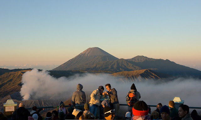
    This 2.392 meters above the sea level mount is famous for its wide sandy area and large crater. Taking a bird`s eye view from the top of the mount, you will see the large crater bleaching out thick smoke from the bottom. The crater is 800 meters in diameter (north to south) and 600 meters in diameter (east to west). From the same place, you will see the panoramic view of sandy area with naturally splendid silhouette of the surrounding places.

    Watching the sunrise from the peak of the mount, hanging around the location by riding horse and tasting a glass of local beverages while having a bonfire against the cold weather are some alternative activities for you visiting the destination. Besides of natural tourism that will be experienced, you will be familiar with cultural tourism atmosphere, especially when the ceremony of Yadnya Kasada is held. In addition, for you who want to watch the ceremony of Yadnya Kasada, you better come to Mount Bromo during December to January.

    Mount Bromo


    Mount Bromo Location

    Mount Bromo lies in four different districts: Pasuruan, Probolinggo, Lumajang, and Malang. All are in East Java Province. However, administratively, it is located in the district of Probolinggo. You can access Mount Bromo by using either public transportation or private car. To reach the location, you can acceess via “the western gateway” from Pasuruan District. However, accessing the location via the western gateway will be hard as it can only be accessed using jeep car. In general, most of visitors tend to reach the mount by walking from Wonokirti Village for about 13 km away.

    Accessing the mount via “the northern gateway” from Probolinggo District. Via this way, you may use any public transportation remembering the access to the location is not too steep. If you want to watch the sandy area of Mount Bromo, it is better for you to pass by this way. Otherwise, if you want to watch the sunrise, just take the trip through the western gateway.

    The nearest village to the mount is Cemorolawang Village around 45 km away from Probolinggo District. It can be reached by public transports from Probolinggo. In addition, to reach the mount from Cemorolawang Village, you had better charter a horse or jeep car and you may walk as well.

    Bonfire provided by some food tents can be alternatives for you against the cold weather in the location while tasting lukewarm beverages. When you need to spend more days there, you can easily find lodgement, shelter and hotel around the destination. Multifarious restaurants, souvenir shops can also be found there proposed to offer comfortable visit for you.

    Thursday, February 8, 2001

    Mount Inerie

    Mount Inerie

    Mount Inerie, at an altitude of 2.245 meters, had ever erupted in 1882 and 1970 on dry season, during June to August. The west side of the mount‘s slope is dominated by thick forest while the east side of the mount is not converted into farming land. Most of the forest in the area of Mount Inerie are situated at 1.000 – 1.500 meters above the sea level.

    Mount Inerie


    You can see the entire panoramic view of Bajawa City, on the north-west, which is covered with slight mist above the city. On the south of the mount, the blue sea of Sawu lies in the slope of the mount.

    Mount Inerie


    There is a myth about a big stone located in the south of the mount. The big stone is believed as a materialization of Jaramasi and his horse. Jaramasi, jara means horse and masi is a name of a man, is assumed as the guardian knight of Mount Inerie.

    Mount Inerie Location

    Mount Inerie lies in Bejawa Sub-district, Ngada District, Flores Island, East Nusa Tenggara Province, Indonesia. To reach the destination, you can take air transportation from Kupang to Ende, in Flores Island. Having arrived at Ende City, you can continue the trip to Bajawa for about 61 km away. From Bajawa, go to the location by public transportation to the location, around 15 km southwards. In Bena Village, you can find some inns for you who want to spend more days around the location.