• Beautiful Lake Maninjau : West Sumatra Destination

    Lake Maninjau is a volcanic lake that is located at 461,50 meter above the sea level. Its width is 99, 5 km2 with 4, 95 meter of the maximum depth. The existence of Lake Maninjau has created a folktale called "Single Sembilan" (The nine Bachelors). People living around the lake believe that those nine Bachelors are real...

  • Bantimurung Waterfall the Best Destination in South Sulawesi

    Bantimurung waterfall (15 meters in height and 20 meters wide) is a very famous natural tourism destination in South Sulawesi. Pure water falls down from the crag every year. Beneath the waterfall, there is a bathing place made of limestone covered by mineral vein which is caused by the stream flow for hundred years....

  • Nimanga River, Best Rafting in North Sulawesi

    Nimanga River is one of the most favorite tourism destinations in the North Sulawesi. It has been popular as it is used for any kind of extreme sports and other activities. It will be great experience for having an extreme sport such as rafting along the river...

Showing posts with label Forest. Show all posts

Wednesday, July 12, 2006

Camplong Forest Area

Camplong Forest Area

Camplong Forest Area is a forest conservation that is inhabited by various floras and faunas. The area is situated on the slope of Mount Fatuleu in East Nusa Tenggara Province. In the location, you will find a pond and a natural water spring enhancing the fresh atmosphere around this site. Multifarious floras, such as red woods, pines, palms, and eucalyptus, and faunas such as apes, squirrels, cuscus, and birds, are deliberately kept from extinction there. In addition, weekend is the right time to visit the location along with your family or friends.

Camplong Forest Area is a resident for numerous endemic faunas such as timor deer, olive-shouldered parrots, and black-backed fruit-doves. Besides, this forest area is also preservation for kinds of crocodiles and snakes. Endemic floras like cendana wood (Sanatalun Album) are also available there as well.

To some extent, you likewise will see an artificial cave that was made when Indonesia was under the rule of Japanese colonial government. According to the available data dealing with the history of the cave, Japanese troops used to hide inside the cave when they got retaliatory attack by Indonesian soldiers.

Camplong Forest Area Location

You can take public transport leading to Soe City by approximately IDR 7.000 for its cost. However, it will be IDR 100.000 for taking taxi to reach the location. For accommodation services, you can easily find some lodgements around the location with reasonable prices.

Friday, July 8, 2005

The Nature Preserve of Kaget Island

The Nature Preserve of Kaget Island
Kaget Island

Kaget Island is one of the tourism destinations located in the forest of Barito Kuala sub-district. The island is a delta close to the mouth of the Barito River. The island is inhabited by kinds of monkey with long nose which are known by the people as the Dutch Monkeys/Bekantan (Nasalis Larvatus). They are known for having long noses, red faces, and big bellies. There are also a number of different types of birds in this area. This area which is 85 Ha wide is established as a nature preserve in 1976 due to the decree of Agricultural Minister No. 788/Kptsum11/1976.

The local government of South Kalimantan enacted the Bekantans as the mascot of the province in 1990 according to the decree of the Governor. The I Provincial Chief Executive of South Kalimantan No. 29, dated on  January 16th,1990 and was agreed upon by (Provincial House of Representative) DPRD I South Kalimantan which is written on the decree of DPRD No. 162/112/DPRD, dated on March 28th, 1990.

The enacting of Bekantans as the mascot of the province results in strategic benefits for the area both as its symbol and as a tourism destination. As a habitation of preserved beasts, the nature preserve of Kaget Island becomes one of a well-known tourism sites for domestic and foreign tourists.

The Nature Preserve of Kaget Island
a Bekantan in Kaget Island


Unfortunately,  the existence of illegal lodging and environmental pollution drag the island into critical situation. Rambai Padi (Sonneratia Caseolaris), the main food of Bekantans, is one of the trees which are mostly threatened. It puts the beasts in danger as their numbers are decreasing.

The visitors will see various preserved animals around the destination, Bekantan. The preservation of the beasts is written in the law: The law of prevention to cruelty animals No. 2666 year 1931, the law No. 5 year 1990, the decree of Forestry minister no. 301/Kpts-II/1991, the decree of Forestry Minister No. 882/Kpts-II/1992, and the Government Regulation No. 7 year 1999. These beasts are internationally categorized as vulnerable in IUCN (International Union for conservation of Nature and Natural Resources) Red Data Book and is enclosed in Appendix I of the CITES (Convention on International Trade in Endangered Species of Wild Flora and Fauna).

Those who visit this place for the first time will be surprised or will spontaneously drag a friend‘s hand when suddenly hear a sound from the leafy trees “nguuk…nguuuuk, nguuuuk….”, which is actually the sound of hundreds of monkeys. The sound of Bekantan will always stuck on thevisitors‘ head. They also will be amazed to witness the beasts which are known to be shy and only be found in Kalimantan, energetically hanging around from one tree to another.

Where Kaget Island Location?

Kaget island is located in the district of Tabunganen, Barito Kuala, South Kalimantan ProvinceThe visitors can reach Kaget Island using speed boat from Banjarmasin which takes around 15 minutes or around 1, 5 hours using kelotok.

Wednesday, January 19, 2005

Batu Raden

Batu Raden

Batu Raden is a worth visiting tourism destination located in Banyumas District, Central Java. Since the first time it was officially launched for public visit, the location has been known as a mountainous tourism destination. Here you can see the wonderful scenery of the surrounding areas offering fresh air with approximately 18º - 25º Celsius in the average temperature.  Taking a bird-eyes view from the peak of the location when the sun shines brightly, you can see the entire part of beautiful scenery of Purwokerto City, Nusakambangan Island, and some enchanted beaches in Cilacap coastal area. Batu Raden, 16,5 hectares in width of which 25 percent of the entire width, is opened for public investment (go public).

The name of Batu Raden itself stems from two Javanese words that are Batur (hill, land, friend, and assistant) and Raden (noble person). The combination of Batur and Raden then creates an interpretation that Batu Raden is a flat area possessing beautiful scenery.

Batu Raden


Two folklores dealing with the origin of Batu Raden comes from Sheikh Maulana Maghribi and Kadipaten Kutaliman. According to Sheikh Maulana Maghribi, once Prince Rum from Turkey saw a mysterious light in the easternmost of Asia. Being eager to know what kind of light it was, he undertook an investigation to a place that now is known Batu Raden. In a short, after he reached the location, he found the source of the light that came from a Hindu hermit was leaning on a rose-apple tree.

Another story telling the origin of Batu Raden takes form in a romantic story involving Adipati Kutaliman, his consort, and his servant. There was a time that the consort fell in love with the servant. Knowing that relationship, both were alienated from royal family. No longer had they gone out from the royal family, the consort gave birth to a son in a riverbank located in the northern direction of Kutaliman District. The location where the consort gave birth now is known as Batu Raden.

Batu Raden


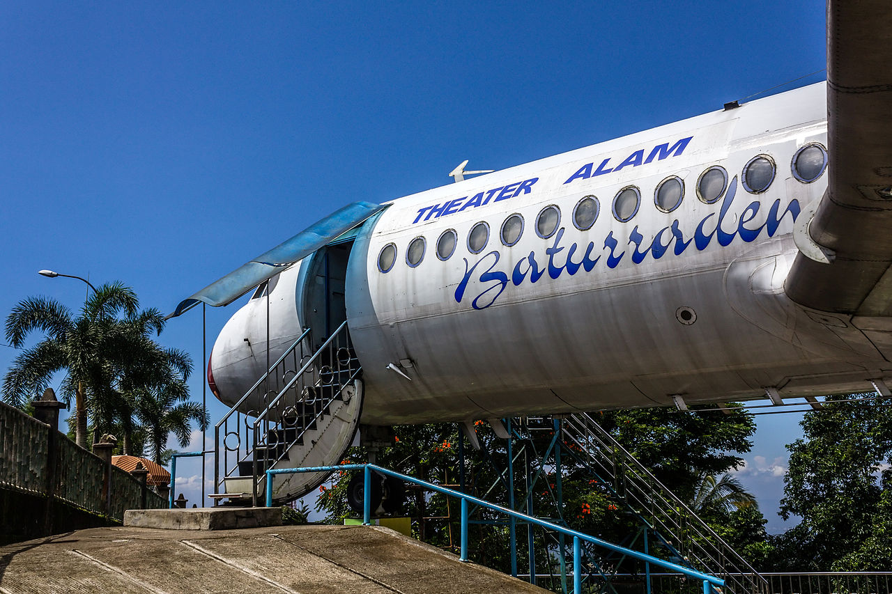
Batu Raden is famous as a tourism destination where some other tourism destinations are available. You will discover some other interesting objects such as follows:
  • Botanical garden. Find multifarious flowers and other rare floras such as Havana flowers, Daun Dewa, Brimulia, Keladi Tikus, Antarium Lipstick, Paris Palm, and Widoro Laut. All these colourful flowers are available either for display or sold, hence you can buy them as souvenirs with reasonable prices.
  • Curug Gede. This site is located at Ketenger Village, approximately three kilometres from Batu Raden, where a beautiful waterfall exists there.
  • Pancuran Pitu. This site lies 2,5 km from Batu Raden – on the slope of Mount Slamet – and is a hot water spring - 60º - 70º Celsius in average.
  • Pancuran Telu. This site is officially launched on January 18th, 1987. The water from this site bears efficacy to heal some diseases that distinguishes the location from the others.
  • Wana Wisata. Lying two kilometres from Batu Raden, this location possesses enchanting green forest scenery and is the right place for camping.
  •  Telaga Sunyi. A tranquil location wherein a pond with pure water is present there. This site is located about two kilometres eastern direction from Batu Raden.
  • Kaloka Widya Mandala Park. Invite your family here for the educational recreation. This location is a zoo where you can find various faunas inhabiting within. Moreover, here you can also visit a museum wherein numerous rare species bones are kept well.

Likewise, you may also experience cultural tourism like:
  • Grebeg Syura or Sedekah Bumi. This rite is commonly held on the ninth day of the first month of Islamic calendar. This rite is aimed at preventing bad deed and expelling evil spirits that may occur in this city.
  • Kenthongan (a bamboo tube).
  • Calung (a bamboo xylophone) and lengger. Calung is a musical instrument resembling a xylophone that is made of bamboo of which is played by striking on its body. Lengger is a traditional dance performed by two girls that is followed by musical tone from calung.
  • Banyumas traditional clothes. In Banyumas District, you can find two models of traditional clothes categorized based on the Banyumas people‘s social status, which are wong cilik (proletarian) and bangsawan (high class). Traditional clothes for proletarian take form in ancingan, bebed wala, pinjungan, iketan, and nempean, while high class‘s traditional clothes are usually called beskap – for male – and nyamping – for female.
  • Ebeg or Kuda Lumping. This one is the Javanese hobby-horse trance dance that is commonly performed by several male-dancers sitting astride on bamboo horses. This traditional dancer is usually followed by traditionally musical performance namely bendhe.
  • Sadranan. Visiting to a holy site, usually graveyard, then is preceded by kenduren – the Javanese ceremony for preventing the village from evil spirit.

Baturaden Location

You can find Batu Raden on the slope of Mount Slamet. This location is situated at an altitude of 640 meters. You can reach the location from the heart of Purwokerto City (14 km in distance), Banyumas District, Central Java Province. You can easily access the location by taking any public or private transport. It usually spends about 15 minutes, when the road is not crowded, from Purwokerto City.


You need to pay IDR 3.000/person. However, you have to pay additional entrance ticket for these conditions below:
  • IDR 1.000 for those who take a motorcycle inside the location
  • IDR 4.000 for those who take private or chartered cars, unless a minibus, inside the location
  • IDR 5.500 for those who bring a minibus inside the location
  • IDR 1.000 to visit a botanical garden inside the location
  • IDR 1.000 to visit Curug Gede
  • IDR 5.000 to visit Pancuran Pitu, Pancuran Telu, and Curug Gede
  • IDR 2.500 to visit Kaloka Widya Mandala Park.
Your visit to Batu Raden will be more exciting as there are supporting facilities that are intentionally provided by the location‘s management. Those supporting facilities are:
  • Swimming pool (IDR 1.500 of entrance ticket)
  • Body-sliding pool (IDR 1.500 of entrance ticket)
  • Sulphurous bathing pool (IDR 15.000 of entrance ticket)
  • Water cycling (IDR 1.500 of entrance ticket)
  • VIP class Hot water pool (IDR 3.000 of entrance ticket – 15 minutes in maximum)
  • The first class Hot water (IDR 2.000 of  entrance ticket – 15 minutes in maximum)
  • Merry-go-around arena (IDR 1.500 of entrance ticket)
The areas surrounding Batu Raden offer various choices for you who want to stay more days there. You can find lodgements, small hotels, and inns around the location. In the east of the location, you can, likewise, easily find hotels and inns. However, the center for numerous hospitality services are located in the west of the location, where you can easily find tour and travel agents, restaurants, public buildings, spas, bungalows, souvenir shops, and many more.

Monday, January 17, 2005

The Forest Area of Mount Klabat

The Forest Area of Mount Klabat

The forest area of Mount Klabat encompasses a 5.300 ha area which is situated on the highest mount in North Sulawesi namely Mount Klabat (1.990 meter above the sea level). This forest area is a right place for mountain trekking lovers who want to enjoy the enchanted view of surrounding nature.

In the early years of Indonesian Independence Day, Mount Klabat or gunung hutan (Forest Mountain) was utilized by `anti-Indonesia` people as a sanctuary from Angkatan Bersenjata Republik Indonesia-ABRI (Indonesian Armed Forces).

Exploring this forest area, you will discover multifarious floras and faunas that are intentionally preserved by Minahasa local government. The forest area of Mount Klabat has four dipterocarps which may also be used as campground. Those four dipterocarps are hilly dipterocarp forest area, upper dipterocarp forest area, montane forest area, and ericaceous forest area.

The Forest Area of Mount Klabat


There are six check posts along the footpath leading to the top. The first post – Aermadidi – is the starting point to reach the peak of Mount Klabat. In that post, you need to register your name and identity for safety during the visit to Mount Klabat. You will pass by a coconut plantation nearby the first post.

It spends approximately four hours to reach the peak of Mount Klabat by walk. You are allowed to ask for guides from professional tour operators who will heartily accompany you during the visit. On Sunday, the location is densely visited by visitors, hence if you want to experience a tranquil holiday, avoid visiting the location on that day.

Mount Klabat Location

Mount Klabat lies in Aermadidi Sub-district, Manado City, North Sulawesi. It is 18 km distance from Manado. To reach the location by taking public transport, it spends approximately 30 minutes. You may take public transport to reach Aermadidi Sub-district from Manado City. After 30-minute journey from Manado, you will pass by a gateway to Mount Klabat.

Friday, November 12, 2004

Punti Kayu Forest Park

Punti Kayu Forest Park

Punti Kayu Forest Park is the only forest tourism destination in Palembang City. Around this 12 ha area, you will be sheltered by numerous pine trees. Punti Kayu Forest Park is a right place for you who want to have a pleasure vacation amidst the crowded of Palembang City. You may have your children ride some tamed-elephants, swim in a pool, and visit fauna museum. In several occassions, there will be musical performance.

Punti Kayu Forest Park


Punti Kayu Forest Park is six kilometers awat from the heart of Palembang City. It lies on Kolonel Barlian Street, Palembang City, South Sumatra Province.

Punti Kayu Forest Park


The entrance ticket to Punti kayu Forest Park is IDR 5.000. If you want to take motorized boat, you need to pay IDR 500/person. It costs IDR 2.000 for swimming in the pool. The entrance ticket to the zoo and fauna museum is IDR 500/person. There is an artificial lake, souvenirs shops, playground, and restaurants around Punti Kayu Forest Park.

Thursday, February 20, 2003

Forest Tourism of Malino

Forest Tourism of Malino


Malino is a tourism place with a very astonishing natural panorama. At the place, 1.500 meters height above the sea surface, there is forest tourism of Malino that is known as pine forest consisting of fertile, hefty, and leafy pine trees carpet. Besides, at this place It is also found the markisah estate of producing special beverage from Malino city, that is Markisah juice. With the beautiful mount, the leafy pine trees, the markisah tree, the cool and fresh air as well, all of which make this place visited by numbers of tourists, both domestic and international, especially on holidays.

The visitors can see the marvellous natural enchantment, with fertile, green, and leafy pine forest. Besides, the scarce Dutch inheritance, Edelweis and Sesbania trees with orange flower, and Masamba flower, can also be found here. The colour of the plants can change every month, from green, yellow, to white. On the top of Malino Mountains, there is vegetable garden , making the location more enchanted.


Forest Tourism of Malino


If the visitors wanted to feel different atmosphere, around the tourism place of Malino forest, there are other tourism places such as Takapala Waterfall in Bulutana, and Lembanna Waterfall which is about 8 kilometres from Malino City, Lembah Biru Pool, tea estate of Nittoh from Japan in Pattapan, horticulture plants in Karenpia, and the various flora and fauna.

Where Access Malino Location?

The Malino is in the South of Makasar City, precisely in the sub-district of Tingimoncong, district of GowaSouth Sulawesi ProvinceIndonesia. The tourism place of Malino Forest is about 70 kilometres from Sungguminasa City (Gowa) or 90 kilometres from Makasar City


Forest Tourism of Malino


From Sungguminasa, the trip could be taken for 2-3 hours by private or public transportation. For the visitors who wanted to enjoy the beauty of Malino nature much longer, don`t be worry, as this place is provided with hotels and villas to spend night. At the waterfall tourism location, there is a hotel with cost only IDR 50,000.00/night/room. There is lot of hose rents for tourists who want to reach Takapala Waterfall, about 4 kilometres from the South of Malino.

Monday, January 7, 2002

The Adventure of Bangkirai Hill Nature Tourism in Balikpapan Indonesia

The Adventure of Bangkirai Hill Nature Tourism in Balikpapan Indonesia
Bangkirai Hill Nature Tourism


Bangkirai Hill is one of captivating tourist  destinations situated in East   Kalimantan Province.  The hill provides the perfect ambience of tropical rain forest with its mild  climate and laid back charm. There, the tourists will have great experience of  walking around the forest which is still in its natural state. Covering an area  of 1.500 hectare, the hill constitutes a forest conservation which aims at  developing tropical rain forest in the region. In addition, some of protected wild  species live within. It is an educational tourist destination for the nature  lovers and for those avid biological scientists.

The hill got its name “Bangkirai” as it houses thousands  of Bangkirai trees, some of which  are  more than 150 years with their height around 40-50 meters and diameters about  2,3 meters. The site is officially opened for public on March 14th,  1998.


The Adventure of Bangkirai Hill Nature Tourism in Balikpapan Indonesia


One of Bangkirai Hill`s distinctive features is its  challenge for the tourists to tread a canopy bridge perching over at 30 meters  above the ground. It is 64 meters long, connecting five big Bangkirai trees. It  also serves an alternative therapy for those who have heights phobia. On the  bridge, interspersed with moderate wind, you can enjoy the picturesque verdant forest  and valley steeped in color. If you walk on it, the bridge will move rhythmically  from side to side. But, once you try it, you will be eager to repeat the bridge  trip. This canopy bridge is the first built in Indonesia,  the second in Asia, and the eight in the  world.

Where Bangkirai Hill Location? 

Bangkirai Hill is located in Samboja sub-district, Kutai Kartanegara district, East Kalimantan province, Indonesia. Bangkirai Hill is at a distance of about 150 km from Tenggarong City  or Samarinda, while of about 58 km from Balikpapan City  and 20 km from the capital of Samboja sub-district. To reach the location, by  land, the tourist can use any accessible transportation such as motorcycle or  car.  This tourist object is completed with  adequate facilities: a meeting hall that will seat 100 people in comfort, a restaurant  offering exquisitely different menus, cottages equipped with AC, and jugle  cabin (the natural hotel with no electric facilities/natural room). The  tourist who want to enjoy the beautiful scenery of Bangkirai can reach Inhutani Balikpapan, Ltd at (0542) 736066-734644.