• Beautiful Lake Maninjau : West Sumatra Destination

    Lake Maninjau is a volcanic lake that is located at 461,50 meter above the sea level. Its width is 99, 5 km2 with 4, 95 meter of the maximum depth. The existence of Lake Maninjau has created a folktale called "Single Sembilan" (The nine Bachelors). People living around the lake believe that those nine Bachelors are real...

  • Bantimurung Waterfall the Best Destination in South Sulawesi

    Bantimurung waterfall (15 meters in height and 20 meters wide) is a very famous natural tourism destination in South Sulawesi. Pure water falls down from the crag every year. Beneath the waterfall, there is a bathing place made of limestone covered by mineral vein which is caused by the stream flow for hundred years....

  • Nimanga River, Best Rafting in North Sulawesi

    Nimanga River is one of the most favorite tourism destinations in the North Sulawesi. It has been popular as it is used for any kind of extreme sports and other activities. It will be great experience for having an extreme sport such as rafting along the river...

Thursday, September 20, 2001

Suhom Waterfall

Suhom Waterfall
Suhom Waterfall


Nowadays – after the political conflict occuring in Aceh was over – Suhom Waterfall is frequently visited by tourists coming either local or international. The situation was different when the political concflict occurred in Aceh. It was rarely visited by tourists. For you who want to know more about the waterfall and surrounding area, you will be accompanied and guided by the local inhabitants during the visit.

It is situated in the middle of a forest offering the maginificent view of surrounding area. It is encircled by durian trees (Durio zibethinus), so it is likewise famous for numerous people selling durians during the harvest time of durians. Campground located next by the waterfall is a right place for you who want to experience the sensation of spending night in the location while enjoying the beauty and the magnificent of the nature.

The water flowing from the waterfall is functioned as the electricity generator in Krueng Kala Village. It is operated to distribute the electricity power to 200 families in Krueng Kala Village.

During the journey to the location from banda Aceh City, you will be offered the wonderful panoramic view of the pounding wave along the seaside. Moreover, mountanious areas standing in a row along the road is a distinction from other destinations that can only be found in the location.

Suhom Waterfall Location

Suhom Waterfall lies in Suhom Village and Krueng Kala Village, Lhoong Sub-district,  Aceh Besar District, Nangroe Aceh Darussalam Province, Indonesia. To reach the location, it will spend approximately an hour by public transportation via the route Banda Aceh – Calang (Aceh Jaya) passing by Lampuuk Beach, Lhoknga Beach and Leupung Sub-district. There is no lodgement or inn around the location. Therefore, you must carefully consider for spending night there. However, you can spend the night there by building tents around the location which has a right place for camping.

Monday, September 17, 2001

Wonderful of Manggar Segarasari Beach in Balikpapan

Wonderful of Manggar Segarasari Beach in Balikpapan
Manggar Segarasari Beach


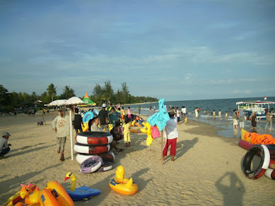
The Manggar Segarasari Beach  is a worth visiting tourism destination in Balikpapan,  East Kalimantan province, Indonesia.  Clear water and white grain sand offer you a panoramic view for a tranquil  holiday. The entire extent of the destination is around 13 km squares.

As the Manggar   Segarasari Beach  has a wide area, you can do activities to kill the time of your holiday while  enjoying the pounding waves that is not too high. Playing football, flying  kites, swimming, and having an adventure by the rubber canoes can be  alternative activities for you. It is opened for public at 6 a.m. until 6 p.m.

How to Access Manggar Segasari Beach Location?

The Manggar Segarasari Beach  lies amid the villageof Manggarand the villageof Teritip, East Balikpapan sub-district, Balikpapan City, East Kalimantan province.To reach the destination, you may use either motorcycle or  car. The access is about 22 km from Balikpapan, and  9 km eastwards from Sepinggan   Airport. Besides using  your own private transportation, or the number seven way of public  transportations, as alternatives for you.  The Manggar Segarasari Beach has been provided with parking  area, information room, shelter, placard direction, food tents and stalls  (usually offer you Bakso (Meatball), Young Coconut Ice, Gado-gado, etc),  rest room, and others. You may hire rubber canoes (about Rp. 5.000 to Rp.  10.000), balls (about Rp. 10.000), or rubber canoes for two people (about Rp.  15.000) and swimsuits.  

Friday, August 17, 2001

Rencong, Traditional Weapon from Aceh

Rencong, Traditional Weapon from Aceh
Rencong

Rencong is a traditional weapon from Aceh that is made of white metal, brass alloy, and horn of buffalo (white or black). During the colonialism of the Dutch, rencong was used either by men or women in the battle field to battle the Dutch. Rencong is slipped into the scabbard and worn on the left hand side of the stomach directed to the right hand. The way of wearing rencong depicts the egalitarianism, social status, and is also the symbols of self defense, bravery, and heroism in fighting the Dutch.  Noted that some great heroes coming from Aceh such as Cut Nyak Dien, Cut Meutia, Pocut Meurah Intan, Pocut Baren and Tengku Fakinah used rencong to fight against the Dutch. They were the silent witnesses of Aceh people‘s bravery in efforts to defend Indonesia, especially Aceh Province from the occupation of the Dutch colonial government.

Nowadays, rencong is a souvenir from Aceh Province. That is why, we suggest you to buy rencong as your souvenir when visiting Aceh Province.

One of the distinctive features of rencong is on its making process. The making process of rencong using white metal as the basic material is rather difficult than using brass alloy. There are four types of rencong in Aceh Province; pudoi, which has not had perfect shape yet on its handle; meukure, decorated with various motifs such as animal, flower, and root; meupocuk, having gold filigree at the upper end of the handle; and meucugek which is on its handle glued something called cugek (a glue and 90 degree of angle).

The Islamic philosophies of rencong are on its handle engraved ba letter (Arabic scripts), as well as on the base of the handle, sin letter. On the bottom of the blade is mim letter while lam letter is along the blade. Those Arabic letters on rencong sound basmalah (in the name of Allah).

Where Find Rencong Home Industry Location

You can find the center of rencong home industries in Baet Masjid Village, Baet Meuseugoe Village, and Baet Lampu ot Village. Those are in the sub-district of Sibreh, Aceh Besar District, Nangroe Aceh Darussalam Province. It is about 25 km away to reach those three villages from Banda Aceh City by any public transportation for approximately 45 minutes. 

Rencong, Traditional Weapon from Aceh
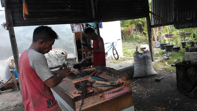
Rencong Industry

The price of a rencong depends on its quality, including the material of the blade and the handle and its size as well. For a medium rencong (10-12 cm long) made of brassalloy, the prices range from IDR 20.000 to IDR 75.000. A bigger rencong, more than 12 cm long, vary in price from IDR 75.000 to IDR 80.000. The highest price of rencong is rencong made of white metal as the basic material. Fur currently, there is no guesthouse around those three villages. However, you can observe in more detail its making process. Moreover, you can order a rencong based on what you want. You can choose every material for your Rencong starting from choosing the horn and the material for the blade. Almost all the rencong makers are men. Their knowledge in the making of rencong is inherited from their parents. rencong made by those three villages are distributed to several districts in Aceh Province, especially in the traditional market in Banda Aceh City.


Wednesday, August 15, 2001

Visiting Mayura Water Park in Lombok Island

    Visiting Mayura Water Park in Lombok Island
    Mayura Water

    Visiting West Nusa Tenggara province will not be complete  before visiting Mayura Water Park.  It is a unique and special water park; the combination of park and the concepts  of pond and shrine which are fully decorated by the motives of Balinese,  Javanese and Lombok, will amaze you visiting  the location. It was built in the era of Bali  Kingdom when they held the power in Lombok Island  by A.A. Made Ngurah Karangasem king in 1744 A.D. It was called KelepugPalace, derived from Kelepug (The  sound of swift water stream from the spring in the centre of the pond).
    In the era of Mataram   Kingdom, it had been  renovated under the decree of A.A. Ngurah Karangasem King in 1866 A.D. Not only  physical building that was changed, but also its name that was turned into Mayura.  Mayura, derived from Sanskritmeans peacock. Once upon a time, in  the era of A.A. Ngurah Karangasem King, there were snakes in the palace  disturbing the activities in the palace. Therefore, a counselor suggested that  the palace had to breed peacocks in order to chase away the snakes. Its  strategic location and the historical values cause the location is visited by  tourists either local or foreign tourists.


    The Mayura   Water Park  offers you the combination of natural, religious, and historical nuances.  Tranquil felling is the first impression when you enter the location. There is  a pond which is neatly organized to improve the natural nuance of the location.  In the center of the pond, there is a small building called “Bale kambang” or Gili (in local language means small islands). You will see many mangosteen  trees planted in a line. You may pick the fruits if the guides permit you.
    Some buildings in Balinese motive combined with the  influence of Javanese and Lombok   Island shape up a religious  nuance in the location. Based on the guides` explanation, the main spot of the  location is a shrine located in the upstream of the pond. However, visitors  often miss the shrine since the location, the size of the pond that are too  wide, and the leafy mangosteen trees. Its name isKelepug, which is  meant to remind the earliest name of the location. At some rituals, the temple  is functioned as worship place.
    There will be some guides explaining the history of Mayura Water   Park. One of the interesting  stories about its history is a statue having a western Asian face. It was a  gratitude to a western Asian person for his idea to breed some peacock to chase  the snakes in the palace. In addition, Bale Kambang was built because of  the inhabitants` pressure for justice. The trial process was held in the Bale  Kambang in the era of Rad Kerta. There will be more information about its  history and amazing concepts of the building.

    Where to Access Mayura Water Park Location?

    Mayura Water Park is located in a business center, Cakranegara sub-district, Mataram city, West  Nusa Tenggara province. It will be 15 minutes from Narmada  bus station. It can be accessed by public transportation about Rp. 5.000 in  cost or you may get taxi which cost is about Rp. 15.000. You can also start the  trip from Mataram for about 10 minutes with Rp. 2.500 in cost by public transportation  or Rp. 10.000 by taxi. The entrance ticket includes the guides` services. They will  tell you about the concept and the history of the location. They will invite  you look around the location in approximately 15 minutes, after that, they will  allow you to take an observation alone.

    There are hotels and restaurants nearby this historical  tourism destination. Considering that the location is a business centre, you  will find food tents and stalls offering the ethnic cuisines of Lombok Island  like Pelecing.

The Exotic Panorama on Matras Beach, Bangka Belitung Island

The Exotic Panorama on Matras Beach, Bangka Belitung Island
 Matras Beach

Matras Beach is a beautiful and sloping sandy beach where the white grain sands spreads out like pearls offering the splendid view of its nature. It is 2 km in length with around 20 to 30 meters wide where some leafy coconut trees welcome you. The white sands combined with the wonderful coastal rocks and the water flowing from the river to the sea are stunning sceneries for your tranquil holiday. Therefore, it is commonly called “Pantai Surga” (The beach of the heaven). It is the most popular one among the other beaches inBangka-Belitung Province that is frequently visited by tourists either domestics or foreign.


The white grain sands, the leafy coconut trees, and the natural water flowing from the river are some distinctive features of the location that will be hard to be found in other destinations. Its comfort and the ease offer you an unforgettable holiday while enjoying your meals leaning on the wonderful coastal rocks.


How to Access Matras Beach Location?


Matras Beach lies in Sinar Jaya VillageSungailiat Sub-district, Bangka District, Bangka-Belitung Province. It is the northeast of BangkaIsland, about 40 km from Pangkal Pinang or 7 km from Sungailiat. Taxi or private cars are recommended transportations for you who want to reach the destination. You may start the trip from Sungailiat or Pangkal Pinang. It is approximately an hour from Pangkal Pinang passing by winding road.

There are many airlines that serve the airport for flights to Depati Amir Pangkalpinang such as Garuda, Lion Air, Batavia Air, Sriwijaya Air and others. To arrive at this beach, visitors can use various types of vehicles that can be rented in Depati Amir. If you want to use public transportation, from Pangkalpinang the visitors can take Colt, majoring Pangkalpinang-Sungailiat with cost Rp. 6.000, -.

Friday, July 20, 2001

Takengon City

Takengon City
Takengon City

Located in the highland of Gayo, Takengon City is a worth visiting tourism destination in Aceh Province. It is a city with a panoramic view of its nature in the center of Aceh Province. Lake Laut Tawar, one of the famous tourism destinations in Aceh Province is located in Takengon City likewise.

Many tourists, either domestic or local, come to Takengon City to visit and to spend some nights there around Lake Laut Tawar. Besides, Takengon City also offers you other tourism destinations such as Puteri Pukes Cave, Pantang Terong, Wih Pesam Hot Spring, Terong Hill (Khafi Peak), Loyang Karo Cave, Menye Beach, Ketibung Beach, and the Monument of Pacuan Kuda (horse race). The last one is held in a different way. The jockeys are naturally well-trained children, so they seem amazingly brave to participate in the horse race without using saddle. At least there are 20 tourism destinations in Takengon City, so many choices for you for having tourism there.

The indigenous people of Takengon City come from Gayo tribe that is the offsprings of Batak Karo from North Sumatra. Moreover, the mother tongue of the inhabitants is also different from Aceh people‘s mother tongue.

Dealing with its locaton in the highland of Gayo, Takengon City is famous as a city which has fresh air and maginificent view of surrouding area. Gayo Coffee as the main commodity of Takengon City, has been exported to Japan, USA, and Europe. The other export commodities are tomato, markisa, vegetable, corn, chili, potato, tangerine, avocado, and tobacco.

Takengon City Location

Takengon City is the capital of Central Aceh District, Nangroe Aceh Darussalam Province.Takengon City is the capital of Central Aceh District, Nangroe Aceh Darussalam Province. You can easily access Takengon City from Bireun City, where you can find a small bus station. You can take a type of public transportation that will carry you directly to Takengon City with IDR 25.000 for its costs (January 2008). It is approximately five hours to reach the location from Bireun City. Moreover, you can also reach the location from Blang Kejeren or Kutacane. As an additional information, Bireun City is the capital of Bireun District, Nangroe Aceh Darussalam Province, Indonesia. Remembering that Takengon City is the capital of Central Aceh District, you can easily find some middle-class hotels as well as stars hotels. Nearby the cave tourisms, there are some speedboat rentals with reasonable prices for you who want to enjoy the magnificent view of Lake Laut Tawar.

Monday, July 9, 2001

Hiking and Trekking Mount Rinjani - Lombok Island


The term Rinjani  comes from the old Javanese word which means Majesty. Based on the tale of  Sasak tribe, this is a residence of princess Anjani, the daughter of the  highest deity in Lombok   Island. It was declared  as National Park by the Forestry Minister in 1990. With 41.330 ha in width and  3.726 meters above the sea level, it is considered as the third number of the  highest mounts in Indonesia.  It has tropical climate with 2.066 mm/year of the average amount of rainfall.

Winding, steep and  sheer access to the peak of the mountain will be distinctive challenges for you  who love trekking and enjoying the awesome scenery of its nature. Unstable  temperature will also offer you a thrill holiday that will be hard to be  forgotten. There is a lake  named Segara Anak (about 156 ha in width) in the peak where most of people  around the mount visit it every year to celebrate a customary ceremony. 

It is  totally magnificent scenery where you can find the colorful water of the lake  in 2008 meters above the sea level. In addition, you  can also enjoy the amazing view of the lake and the whole parts of Lombok Island  on a bright weather from the peak of the mountain. Two waterfalls  located in Otak Kotok Gading and Sendang Gile village are mostly visited by  tourists especially on holiday.


Geographically, it  lies in three districts, Central Lombok district, West Lombok district and East Lombok district, Nusa Tenggara Barat province.


How to Access go to Mount Rinjani?

There are three  ways that can be accessed to reach Mount   Rinjani, Sembalun way,  Senaru way, and Torean.


  • By Sembalun way:  starting from Mataram city to Sembalun, East Lombok District (about 4 to 5  hours by any public transportation continued to the peak by walk about 7 hours.
  • By Senaru way:  from Mataram city to Senaru, Central Lombok District, about 3 to 4 hours by any  public transportation continued by walk to the peak for approximately 9 to 10  hours.
  • By Torean way:  starting from Mataram city to Torean, West Lombok District, in 4 to 5 hours by  any public transportation continued by walk for about 8  to 9 hours.


  •