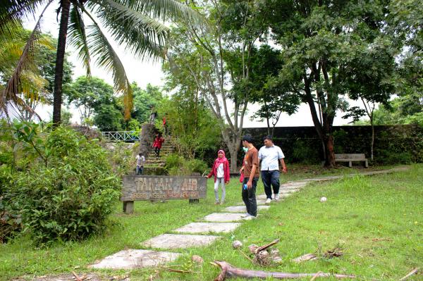
• Beautiful Lake Maninjau : West Sumatra Destination

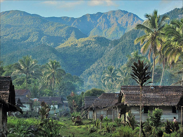
    Lake Maninjau is a volcanic lake that is located at 461,50 meter above the sea level. Its width is 99, 5 km2 with 4, 95 meter of the maximum depth. The existence of Lake Maninjau has created a folktale called "Single Sembilan" (The nine Bachelors). People living around the lake believe that those nine Bachelors are real...

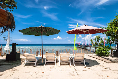
  • Bantimurung Waterfall the Best Destination in South Sulawesi

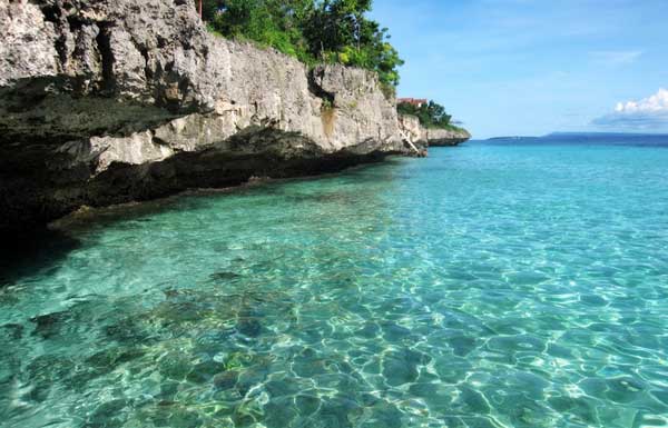
    Bantimurung waterfall (15 meters in height and 20 meters wide) is a very famous natural tourism destination in South Sulawesi. Pure water falls down from the crag every year. Beneath the waterfall, there is a bathing place made of limestone covered by mineral vein which is caused by the stream flow for hundred years....

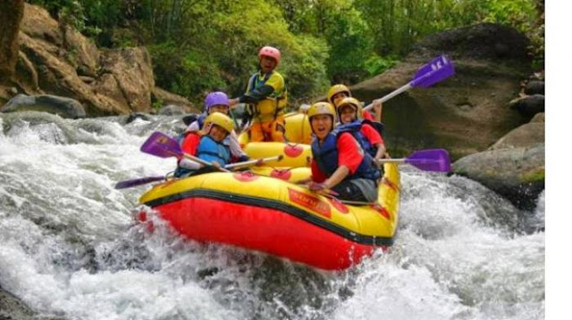
  • Nimanga River, Best Rafting in North Sulawesi

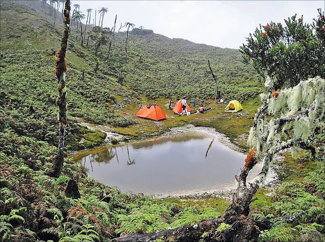
    Nimanga River is one of the most favorite tourism destinations in the North Sulawesi. It has been popular as it is used for any kind of extreme sports and other activities. It will be great experience for having an extreme sport such as rafting along the river...

Thursday, December 23, 2004

The Natural Beauty of Lake Singkarak

The Natural Beauty of Lake Singkarak
Lake Singkarak

Lake Singkarak, which lies amid two districts, Solok District and Tanah Datar District, is the uppers course of the Ombilin River and the Anai River. The Anai River’s stream that is functioned for electricity generator in Lubuk Alung, passes by Barisan Hill Lubung Alung.

With approximately 107,8 km squares in width, it is the second number of the largest lakes in Sumatra Island after Lake Toba in North Sumatra. Moreover, the panoramic view, fresh air and clean water of the lake are the distinction from other lakes in Indonesia.

Lake Singkarak, which is at an altitude of 362,5 meters, is inhabited by various species of fishes, one of them is fish bilih (Mystacoleuseus Padangensisi). This species cannot be bred outside from its native habitat, though it is bred on the floating net in Lake Singkarak. For you, there are many rented traditional boats so that you can enjoy the magnificent view and the enthralling atmosphere of the lake.

The Natural Beauty of Lake Singkarak


On several occassions, the traditional boats competition is celebrated annually at national level. That is why, many tourists come to the location, watching the competition directly while enjoying the beauty of Lake Singkarak.

Lake Singkarak Location

Lake Singkarak lies amid two districts, Tanah Datar District and Solok District, West Sumatera Province, Indonesia. To reach the destination, you may choose land transportations from Padang for about 2,5 hours with IDR 20.000 – IDR 25.000 or its cost. For you who want to charter cars, you must pay IDR 400.000/ each day.You will easily find some hotels or inns around the location. Moreover, restaurants and cafetarias stand in a row along the lakeside, so you can choose whatever you want, based on your taste. 

Wednesday, December 15, 2004

Sriwijaya Zoo


Sriwijaya Zoo is a right place for Palembang people who want to have a pleasure moment with family considering its location that is located nearby the heart of Palembang City. This 10 ha zoo is inhabited by 50 animals. There are three elephants for visitors who want to have a sensation of riding the back of those elephants. Other primates are also available there such as crocodiles, bears, monkeys, snakes, orangutan, and various birds.

Sriwijaya Zoo lies in Talang Taling Village, Gelumbang Sub-district, Muara Enim District, South Sumatra Province. Sriwijaya Zoo is 55 kilimeters away to the north of Palembang City. It lies strategically in Palembang – Prabumulih way.

Thursday, November 18, 2004

Kutai National Park

Kutai National Park
Kutai National Park

This 198.629 ha wide national park is a top-rank tourism destination of East Kalimantan Province. Kutai National Park is commonly used for research, camping, and natural science education, besides for being used as natural tourism. Kutai National Park include into the third biggest number of orang-utan rehabilitation.

Its altitude ranges from zero – 398 meters above the sea level with hilly and winding topography areas. At least there are 60 hills; the highest one is T42 hill, which is at an altitude of 398 meters above the sea level.

Kutai National Park

Kutai National Park has tropical weather, 1.543 mm/ year of average rainfall. It has temperatures in 27º - 33º Celsius. Thus, on April to October is the right time to visit the location.

The distinctions of the locations are its diversified vegetations; mangrove, swamp forest, kerangas forest, lowland forest, and mixture forest. Moreover, Kutai National Park has also heterogeneous plants like sea casuarinas tree, mangrove, tancang, simpur, meranti, benuang, limestone, ulin, Rafflesia Arnoldii, and wild orchids. Some wild animals can also be found there such as orang-utan, proboscis monkey, long-tailed monkey, short-tailed macaque, kukang and Kalimantan owa.

Kutai National Park


Below are some natural activities that can be alternatives for spending the time around the location:


  • Maritime tourism activity and wildlife observation in Teluk Kaba and Muara Sangkimah. Here, you can observe orang-utan, sambar deer, proboscis monkey, honey bear, kanci, and birds.
  • Mangrove observation and maritime tourism in Teluk Lombok and the Estuary of Lombok River.
  • Research and wildlife observation, orang-utan, honey bear, sumbar deer, pig forest, and mouse deer in Prevab Mentoko.
  • Cave tourism, in Cave Lobang Angin.

Kutai National Park Location 

Administratively, the area of Kutai National Park encompasses four sub-districts, North Bontang, South Bontang, Muara Badak, and Marang Kayu, in the district of East Kutai, East Kalimantan Province, Indonesia. Around the location, there are lodgements or inns for you who want to spend more days there. Campground, speedboat, and research laboratory are supporting facilities offered by the Management of Kutai National Park.

Friday, November 12, 2004

Punti Kayu Forest Park

Punti Kayu Forest Park

Punti Kayu Forest Park is the only forest tourism destination in Palembang City. Around this 12 ha area, you will be sheltered by numerous pine trees. Punti Kayu Forest Park is a right place for you who want to have a pleasure vacation amidst the crowded of Palembang City. You may have your children ride some tamed-elephants, swim in a pool, and visit fauna museum. In several occassions, there will be musical performance.

Punti Kayu Forest Park


Punti Kayu Forest Park is six kilometers awat from the heart of Palembang City. It lies on Kolonel Barlian Street, Palembang City, South Sumatra Province.

Punti Kayu Forest Park


The entrance ticket to Punti kayu Forest Park is IDR 5.000. If you want to take motorized boat, you need to pay IDR 500/person. It costs IDR 2.000 for swimming in the pool. The entrance ticket to the zoo and fauna museum is IDR 500/person. There is an artificial lake, souvenirs shops, playground, and restaurants around Punti Kayu Forest Park.

Thursday, October 28, 2004

The Museum of Mulawarman in Kutai Kartanegara District

The Museum of Mulawarman in Kutai Kartanegara District
Museum of Mulawarman

The Museum of Mulawarman is an elegant historical tourism destination in East Kalimantan Province. The building is dominated by white colour. In the past, it was palace then was rebuilt during the tenure of the XIX Sultan of Kutai, Sultan Adji Mohamad Parikesit in 1936 A.D. The architect of this great museum is Estourgie from Hollandsche Beton Maatschappij (HBM).

It was officially established for public on November 28th, 1971 by the Governor of East Kalimantan Province, H.A. Wahab Syahrani. On February 18th, 1976, the museum was taken over by the Education and Cultural Department under the permission of the West Kalimantan Governor at the time.

The Museum of Mulawarman in Kutai Kartanegara District


The Museum of Mulawarman has so much information relating to the Kutai Kartanegara Sultanate. The numerous collection within, especially the inheritance of Kutai Kertanegara Sultanate distinguish this museum from other museums in Indonesia.

Entering the first room, you will see several heritages of the Kutai Kartanegara Sultanate such as the Sultan‘s throne hemmed by two Lembu Swana statues. For its background, two pictures of the XVIII Sultan of Kutai Kartanegara, AM Alimoedin are hung on the wall of the first room. In addition, the picture of Sultan, AM Parikesit and an umbrella of the sultanate are situated in the same location.


The Museum of Mulawarman in Kutai Kartanegara District
The Umbrella of the sultane


You will also discover some archaeological items such as the heritages of Kutai Martadipura Kingdom, the oldest Hindu Kingdom in Indonesia, in shape of inscriptions and statues from the era of Mulawarman King. Some typical carvings of Kalimantan‘s tribes such as Dayak Kenyah, Benuaq, Busang, Modang, Punan, and other Dayak sub-tribes can be found there.

In another room, at the back of the building, you will see the diorama of the birth of Aji Batara Agung Dewa Sakti, the First Sultan of Kutai Kartanegara Sultanate. The diorama of timber industry, coal mining, Mahakam porpoise, and typical plants of Kalimantan can also be found there. After discovering the entire collection within, leaving the building, you must pass by an alley on the ground where much collection of ancient ceramics from Vietnam, Japan, Thailand, and Europe can be discovered there. Outside the building, there is a graveyard of the Kutai Kartanegara Sultanate.

The Museum of Mulawarman in Kutai Kartanegara District
The groundroom of Museum Mulawarman

The Location of Mulawarman Museum

The Museum of Mulawarman is situated on Diponegoro Street, Tenggarong Sub-district, in the District of Kutai Kartanegara, East Kalimantan Province. To reach the destination, you can take any accessible public transportation or motorcycles. It can be accessed through Samarinda City, about 45 km away to Tenggarong. Moreover, it will be around 110 km when you start from Balikpapan. For better understanding about the detail parts of the museum, it is better for you to take guides‘ services. It is opened for public everyday, except Monday, at 8 a.m. until 4 p.m. and you can buy some guidebooks about the museum. There are many food tents around the location for you who want to take a rest after discovering the entire parts of the museum and observing the whole collection within.

Wednesday, October 27, 2004

Wonderful White Sand in Pasir Panjang Beach Bengkalis

Wonderful White Sand in Pasir Panjang Beach Bengkalis
Pasir Panjang Beach Bengkalis

Pasir Panjang Beach encompasses Tanjung Medang, Teluk Rhu, and Tanjung Punak. The local government of Bengkalis District will set the location as the first priority of worth visiting tourism destination.Its white sand that is clean and seems like spreading out of grain pearl, is a right place for having sun bath or other activities. The turquoise water is clean, luring visitors to get plunge into the water or dive. Along this 12 km long beach, you can do any activities such as skiing, or renting motorized boat. Surrounding islands such as Ketam Island, Mentete Island and Baru Island are plus point of the destination improving the panoramic view of the beach. At daylight, you can watch Malaysia across the sea in the distance. At evening, when the sun is going to set, many fish-birds jump upon the sea surface. At clear night, you will see numerous flickering lamps of fishermen’s boats in Malaccan Strait. In the destination, you can do any transaction for trading and selling using Indonesia Rupiah or Malaysian Ringgit.

Pasir Panjang Beach Location

Pasir Panjang Beach is situated in Teluk Rhu VillageNorth Rupat Sub-district, Bengkalis DistrictRiau ProvinceIndonesia. Considering the location that is near to Dumai City, it can be accessed easily by water transportations like motorized boat for about two hours. For you coming from Pekanbaru, you can take water transportations passing by the Siak River, and then stop in Bengkalis. From Bengkalis, the journey is continued by renting speed boat for a day with a million rupiahs for its cost. 


Wonderful White Sand in Pasir Panjang Beach Bengkalis


After being in Rupat Island, there are two alternatives for you to reach the destination, directly go to the white sandy beach of Teluk Rhu, and the last one is directly come to the harbour. Tanjung Medang is the only harbour and the gateway to the destination. For you choosing through Teluk Rhu, you must stop in the middle of the sea, around 60 meters from land, then some traditional boats will pick you up to reach the destination. It is about 15 minutes to reach Tanjung Medang from Rhu Bay by renting motorcycle. There is a 24-hour lodgement around the location for you who want to spend more days. 

Friday, September 17, 2004

Traditional Celebration of Tumbilotohe in Gorontalo

Traditional Celebration of Tumbilotohe

Tumbilitohe derives from Gorontalo language, tumbilo means set and tohe means lamps. Therefore, Tumbilotoho means setting lamps. Historically, it has been celebrated by Gorontalo people since the 15th century. It is usually done on the last three days of Ramadhan month (Fasting month), 27th – 30th of Ramadhan, started from maghrib (6 p.m.) until subuh (4 a.m.).

In the past, it was intentionally aimed for lightening Muslims to distribute Islamic tithe at night. At the time, lightening alliances were made of resin torch and latex. Considering that the stock for resin torch decreased time by time, they had ever turned to padalama (coconut oil) then turned to petroleum.


As the time goes by, now Gorontalo people tend to use modern lamps but some of them prefer to use the petroleum lamps. Those petroleum lamps are hung on every beam decorated by young coconut leaves. Banana, as the symbols of prosperity, are also found on the top of those lamps and also sugar cane as the symbols of sweetness, cordiality and the glory of Eid El-Fitr. This tradition has a distinctive attractive power for the local inhabitants and surrounding people living in Manado, Palu and Makassar.

Gorontalo City turns into a glittering city when the tradition of Tumbilotohe takes place. Every part of public service buildings such as local government office, mosques, even football yard, is decorated by colourful lamps. Moreover, farmlands and empty land are also full of flickering lamps which are painted with beautiful mosque, calligraphy and Al Qur`an pictures.
 

This three-day celebration is more interesting when the attraction of bunggo (bamboo cannons) is played by children competing each other. All of those bamboo cannons are faced to the people`s homes, proposed to awaking the people for having sahur (the meal eaten before daybreak during the fasting month).  By such atmosphere, you will feel its religious nuance and strong solidarity of surrounding people.

Traditional Celebration of Tumbilotohe Location

Tumbilotohe is in the city of Gorontalo, Gorontalo Province, Indonesia. It can be reach by land, water and air transportations. For you living in Sulawesi Island, you can take any public transportation but for you who are outside Sulawesi Island, you must take either water or air transportations. There are two harbours in Sulawesi Island, Gorontalo Harbour and Anggrek Kwandang Harbour in the district of Gorontalo. In addition, for air transportation, there is an airport in the sub-district of Tibawa, Gorontalo District about 35 km from Gorontalo City. There are many supporting facilities such as hotels, restaurants, worship places, car rentals, and communication devices.


Thursday, September 16, 2004

Kampong Gedong: China Town in Bangka Island

Kampong Gedong: China Town in Bangka Island

Kampong Gedong is an old china town that is settled by 50 Chinese families. The first generation of Chinese people migrated to Bangka Island and worked as tin miners. Most of Chinese people in Bangka Island are traders. Some of them produce typical foods of Bangka Island such as chips, kemplang, getas, etc.

In Kampong Gedong, you will see Chinese people‘s tradition that is kept-well from a century ago. Historically, Chinese people living in kampong Gedong are descendants of six bosses holding local tin mining factories in Parit 6 area – Liuk Phun Thew (hakka dialect).

Kampong Gedong usually becomes a place for celebrating Imlek, Peh Cun, and Qing Ming. On those celebrations, there is a figure symbolizing the guardian of kampong Gedong named Sun Go Kong (Sun Wu Gong).

Since 2000, Kampong Gedong has been established as village tourism destination. This decision was drawn because of numerous ethnic Chinese buildings and Chinese traditions that are kept well for hundred years.

Kampong Gedong: China Town in Bangka Island


In Kampong Gedong, you will see antique wooden houses standing in a row decorated with Chinese ornaments and Han Zi calligraphy. Likewise, there are worship place and a China temple that is assumed as the residence of kampong Gedong‘s guardian.

Those buildings and the green surrounding nature offers you exotic view as well as the movies in the 1940s. Such views remind us to some other old towns such as Penang, Malacca, and China Town in Singapore.

Kampung Gedong Location

Kampong Gedong lies about 53 kilometers aways from Sungailiat. The kampong is 14 kms away from Behinyu. The kampong lies 90 kms north of Pangkalpinang. The kampong is located in Kampong Gedong, Lumut Village, Belinyu Sub-district, Bangka District, Bangka Belitung Islands. In Kampong Gedong, you can find lodgements, hotels, food stalls, and China temple. 

Tuesday, August 17, 2004

Mount Binaiya

Mount Binaiya

Mount Binaiya is the highest mount in Maluku Province. The area of the mount ranges from Seram Island to Manusela National Park (189.000 ha). The rainfall average of the mount is 2.000 mm/year during November to April.

Mount Binaiya

In 1972, Manusela National Park was divided into two areas: Wae Mual (17.500 ha) and Wae Nua (20.000 ha). Wae Mual comprises lowland forestry area in the north. Mangrove, resin (Agathis Alba), and meranti tree (Shorea sp) dominate the Wae Mual area. Wae Nua is situated in the center of hilly area. The width of Wae Nua area is 20.000 ha.


Mount Binaiya is 3.055 meters above the sea level. Having an escapade tour, the mount offers you unforgettable experience ever. In the slope of the mount, you will see meandered rivers which have average width between 6 and 8 meters.

Mount Binaiya

Mount Binaiya Location

Mount Binaiya lies in Central Maluku District, Maluku Province. You may take public transport from Ambon City – the capital of Maluku Province – to Tulehu harbor costing IDR 10.000. From Tulehu, you must continue the trip to Seram Island by speedboat. The cost for taking speedboat crossing Malacca strait is IDR 60.000. From Wahai harbor (Seram Island), you may further the trip to Kanikeh Village for approximately six hours. There is no accommodation and supporting facilities around Mount Binaiya since its location in the hinterland of Maluku Province. However, you may spend more days there in the local inhabitants’ houses.

Wednesday, August 11, 2004

Ulee Kareng Jasa Ayah Coffee Shop

Ulee Kareng Jasa Ayah Coffee Shop
Jasa Ayah Coffee Shop

There is a common tradition among the people, especially male, of Nangroe Aceh Darussalam; that is drinking coffee in coffee shops. Nangroe Aceh Darussalam is well known for its numerous coffee shops among other provinces in Indonesia. The difference between coffee shops in Aceh and in Java Island is that the coffee shops in Aceh seem like restaurants. Among the numerous coffee shops in Aceh, Jasa Ayah Coffee Shop is the most popular one. It is owned by Nawawi that has been existing since 1958 by his father, Haji Muhammad.

For Aceh people, coffee shop is more than a place to drink a glass of coffee and some local food of Aceh Province, it is a place to develop social relationship among Aceh people. Moreover, it is also a place to discuss any political issues and economical cases.

Jasa Ayah Coffee Shop is not only famous among Aceh people, but also Indonesian people. Its popularity grew up rapidly after tsunami because many volunteers from either domestics or foreigners came to Aceh. It had also been discussed by International mass media.

Ulee Kareng Jasa Ayah Coffee Shop

Its distinctive taste and its aroma are the best result of the best making process that is made by high quality of Coffee Arabica from Lamno, Aceh Jaya District. Made by special technique full of patient from the frying process (on the lightly frying) until the grinding stage, it produces tasteful coffee. It is better to be served in lukewarm so that the aromatic smell of the coffee can be tasted, even from several meters distance. Moreover, people usually taste it with local cuisines of Aceh like sarikaya cake, timpan cake, bolu cake, martabak telor, nasi gurih (salty rice), and Mie Aceh.

Though Nawawi, the owner of Jasa Ayah Coffee Shop, achieves success in his coffee shop, around IDR 2.000.000 or one a half of coffee in a month, he keeps on being aware of his beyond living. After Tsunami occurring on December 2004, he set a rule that all Muslims must leave the shop when praying times are coming, especially at Dzuhur, Ashar, and Magrib. However, for non-Muslims, it does not matter to stick around in the shop at those times. For him, both world living and beyond living must walk inline.

Ulee Kareng Coffe Shop Location

Jasa Ayah Coffee Shop lies on T. Iskandar Street No. 13 – 14 A, Ulee Kareng Sub-district, Banda Aceh City, Nangroe Aceh Province. Ulee Kareng Sub-district is located in the centre of Banda Aceh City, so there are many public transportations hanging around the location such as taxi, motorized pedicabs, and labi-labi (Ulee Kareng -  Aceh Traditional Market route). As its location in the centre of Banda Aceh City, it will be easy to find some inns or luxurious hotels around the location.As its location in the centre of Banda Aceh City, it will be easy to find some inns or luxurious hotels around the location.

Saturday, July 17, 2004

Gunongan the symbol of Sultan Iskandar Muda`s love to Putroe Phang in Aceh

Gunongan the symbol of Sultan Iskandar Muda`s love to Putroe Phang in Aceh
Gunongan

Gunongan that is situated in Taman Sari (Taman Sari Kingdom) is the symbol of Sultan Iskandar Muda`s love to Putroe Phang, his wife who came from Pahang, Malaysia. As the story goes by, Putroe Phang was full of solitude feeling since the bustle of Sultan Iskandar Muda as a head of state administrations.  She kept remembering her home in Pahang, Malaysia. Fortunately, Sultan Iskandar Muda knew the problem then he built a small mount named Gunongan as a miniature of hills surrounding the Pahang Palace. Since then, Putroe Phang felt exciting. Almost all her times were spent along with other Palace`s ladies by climbing it.

Gunongan is located directly in front of the graveyard of the Dutch fleets. It was built in 1607 – 1636 A.D. on the tenure of Sultan Iskandar Muda in the 17th century. It is not so big; it is hexagonal building which resembling flower with three storeys where on the peak can be found a crown pillar. An entrance door is not too high and keeps on locked. There is a corridor leading to the third storey of the building.

Besides the main building, there is a building called Kandang Baginda. It is a graveyard of the Aceh Sultanate family, one of them is the tomb of Sultan Iskandar Muda`s adopted son, Sultan Iskandar Tsani (1636 – 1641 A.D.) from Malaysia.

The Location of Gunongan

Gunongan lies in Taman Sari Gunongan, Seutui Village, Banda Aceh City, Nagroe Aceh Darussalam Province, Indonesia.Gunongan lies in Taman Sari Gunongan, Seutui Village, Banda Aceh City, Nagroe Aceh Darussalam Province, Indonesia.

Gunongan the symbol of Sultan Iskandar Muda`s love to Putroe Phang in Aceh

It is easy to reach the destination remembering Seutui Village is located in the centre of Banda Aceh City. You can enter the location from the gateway on Teuku Umar Street. There are numerous public transportations around the locations such as pedicab, taxi, motorized pedicab, and labi-labi (typical public transportation of Nangroe Aceh Darussalam). Those public transportations usually pass by Taman Sari Gunungan route, Lhoknga – Aceh Traditional Market, Lamteumen – Aceh Traditional Market, and Lamlagang – Aceh Traditional Market.

Considering the location of Gunungan is in the centre of Banda Aceh City, it will be easy to find either luxurious hotels or middle class hotels around the location.

Tuesday, July 13, 2004

Mount Maras

Mount Maras Adventure

Mount Maras offers you tranquility of green view with scattered farms and leafy trees of surrounding area. Likewise, the mount which is situated at 699 meters above the sea level, presents you wonderful scenery of sunrise in the morning and sunset in the afternoon. We suggest you to bring some foods and tents if you want to climb the mount. There is no food stalls in the surrounding area.

Mount Maras is the only mount in Bangka Island. It offers you magnificent views of its nature and fresh air. The leafy trees in the slope of the mount give you shelter from the sunshine. Spending a night in the location is an unforgettable experience. Flickering lamps of the local inhabitants and twinkling star in the sky are wonderful scenery of Mount Maras in the night. Mount Maras is the right place for hiking, camping, and climbing.

Mount Maras Adventure


Mount Maras Location

Mount Maras lies in Rambang Village, Riau Silip Sub-district, Bangka District, Bangka Belitung Islands. Mount Maras can be reached from either Sungailiat (70 kms) or Belinyu City (33 kms). You can take public transport from Sungailiat to the slope of the mount.

Wednesday, June 16, 2004

Rafting Sensation in the Nimang and Ranoyapo Rivers

 Rafting Sensation in the Nimang and Ranoyapo Rivers

Rafting is a new type of sports that are available in Indonesia. It is a challenging recreational sport pumping up someone‘s adrenalin rush. Just come to the Nimanga River or the Ranoyapo River. There, you will feel the exquisite sensation of exploring the rivers and its distinctive characteristics. There are guides who will accompany you while enjoying the sensation of rafting on the Nimanga River and the Ranoyapo River.

Rafting on the Nimanga River and the Ranoyapo River, which is 35 km long, offers you an unforgettable experience. You will raft above the rough and clean water of those rivers while enjoying magnificent view of surrounding nature and various bird species. This is the right place for having leisure time forgetting any crowded of the city life.

Nimang River Location

The Nimanga  and the Ranoyapo Rivers can be found in Timbukar village, Minahasa District, North Sulawesi Province. The location is about 30 km away from Manado City. You can take minibus from Manado bus station to reach the locations. In addition, taking your own transport will be around three hours to reach those two rivers. You can easily find some hotels nearby the location. Guide services are also available for you there.

Thursday, June 3, 2004

Tour Boats in Glagah Indah Lagoon

Tour Boats in Glagah Indah Lagoon
Tour Boats in Glagah Beach

It would feel a bit incomplete to enjoy the relaxing and refreshing shore of Glagah without getting around on the tour boats. The ride in Glagah Indah Lagoon is a real attraction for visitors especially on holidays. You can feel the hissing waves and breeze on the boat, while beautiful shoreline gives the eyes some kind of enjoyment as you observe your east and west.

The lagoon’s scenic view is actually a small harbor for tour boats, which are ready to take you around to see how beautiful Glagah Beach is. You can find this lagoon as soon as you enter the tourism area. With streams heading for a nearby estuary, the lagoon splits the shore into two, namely the location in which beach plants and grasses grow and the other location which consists of sand dunes and borders with the sea. You can get across by boat to the sand dunes area, which is not far from the estuary. Going around enjoying the beach on the boat is really a moment you will relish.

Tour Boats in Glagah Indah Lagoon


Both visitors and local people like to fish in this lagoon. But aside from that, there are 11 boats ready to add to tourists’ enjoyment on Glagah Beach. Enjoying the beach on a boat can take you away for a while from your routine activities. The boat rider will take you and your group around the beach for about 25 minutes.

Doing some sand play and sunbathing on Glagah Beach are probably what you look for. But going around the location on a boat is something more. You can rent a boat, which is available there. The tour will be on if there are at least 10 people in the boat though. So you may have to wait for a while. But it is always fun there because you can take pictures on the boat or on the shore while waiting for the other passengers. What is more, the 25 minute boat tour is available at a very cheap price, which is Rp 3,000 each person.

Tour Boats in Glagah Indah Lagoon
Glagah Beach

Where Glagah Beach Location? 

Glagah Indah Lagoon is situated in Glagah Beach area, Temon District, Kulon Progo Regency, Special Province of Yogyakarta. Glagah Beach is about 15 km from Wates or 40 km westwards from Yogyakarta. You had better use private vehicles to get there for more ease.

The road is not really difficult as it is mostly plain without too many ascents along the way. You can actually relax on your way there. Moreover, the road connects Glagah Beach with other beaches in Kulon Progo Regency. So after a visit in this beach, you can continue your trip to the other beaches nearby. Before entering the beach area, you will have to pay for the transportation charge, which is Rp 1,000 if you are taking motorcycle, Rp 3,000 for car, and Rp 5,000 for bus. Entrance ticket of Rp 3,000 (per 2010) for each person is not included.

To get around by boat in the lagoon, you will get charged Rp 3,000 per person. The boat will set out with 5 passengers minimum and 10 passengers maximum.

For the parking, you will have to pay Rp 2,000 if you are taking motorcycle and Rp 5,000 for car. As for bus and truck, the parking charge is Rp 10,000.

Monday, May 3, 2004

Kayan Mentarang National Park

Kayan Mentarang National Park

In 1980, Kayan Mentarang National Park, KMNP, was designated as “Natural Reservation Area,” then was changed to “National Park and Forest Tourism Destination” by the decree of Forestry Minister No.631/ Kpts-11/ 1996, in 1996. The entire width of KMNP is around 1.360.500 ha.
With Mount Longnawan as the highest peak, this national park comprises the various landscapes such as flat area, hills and mountainous area, about 200 meters to 2.558 meters above the sea level. It has tropical climate, the average rainfall is around 3.000 mm / year, with the temperature is around 20,5° C to 33° C. During September to December is the best time for visiting the location.
Kayan Mentarang National Park is the biggest and the oldest forest area, both primary and secondary forest, in the Southeast Asia. It is derived from the name of two significant rivers spread out in Bulungan District, the Kayan River, located in the south of the area and the Mentarang River, located in the north of the area.

There are many various species of flora and fauna. The various types of vegetative in the location are categorized by the substrate substance and the variety of topography.

  • The hills and the Lowland of Dipterocarpaceae forest, over than 50 % of the entire width.
  • The Lowland and mountainous forest (at altitude of 1.200 to 1.600 meters) which is over than 40 % of the entire width.
  •  The Kerangas Forest, growing in the low substrate substance.
  •  The Limestone forest.
  •  The Savanna, which is the effect of shifting cultivating.
  •  The Secondary forest, the effect of take and turn cultivating.

You will find some plant species such as pulai (Alstonia scholaris), jelutung (Dyera costulata), ramin (Gonystylus bancanus), agathis (Agathis borneensis), kayu ulin (Eusideroxylon zwageri), rengas (Gluta wallichii), gaharu (Aquilaria malacensis), aren (Arenga pinnata), orchid, palm, etc. In addition, you will see Rhodonderon (the only flower that can be found in Asia).More than 100 types of mammals (15 of them are endemic), eight types of primates, and over 310 types of birds (20 types are Kalimantan endemic threatened with extinction) can be found there. From the mammal species, you will see macan dahan (Neofelis nebulosa), kucing dampak (Prionailurus planicipes), civet cat (Felis marmorata), red cat (Felis badia), honeybear (Helarctos malayanus), bull (Bos javanicus), deer (Muntiacus spp), forest pig (Sus sp), and bajing jenthik (Sundaicurus jentiki subsiganus). The Primates animals such as lutung dahi putih (Presbytis frontata), lutung merah (Presbytis rubicunda), beruk (Macaca nemestrina), bekatan/kahau (Nasalis lavaratus), klampiau (Hylobates mulleri), long tail monkey (Macaca fasicularis), and Tarsius (Tarsius bancanus) can be found there. The species of birds such as kuau kerdil (Polyplectron schleimacheri), julang jambul hitam (Aceros corrugatus), enggang jambul hitam (Anthrococeros malayanus), enggang gading (Bucceros vigil), and cucak rawa (Pycnonotus zeylanicus) can be found in the same location.

Kayan Mentarang National Park


A threatened with extinction species of Kalimantan Elephants (Elephas maximus borneensis), can be found when you are lucky. The species includes into the sub-species of Asian Elephants that was assumed that were intentionally brought to Kalimantan.   According to the survey of Balai Konservasi Sumber Daya Alam, BKSDA (Natural Resources and Conservation Center), WWF and the Biological Laboratory of Forestry Faculty of Mulawarman University on February to March 2007 states that about 25 to 45 of Kalimantan Elephants population which were remained.

KMNP is inhabited by about 20.000 -  25.000 of Dayak people in various sub-tribes such as Dayak Kenyah, Dayak Puran, Dayak Lund Aye, Dayak Tagel, and Dayak Lun Bawang. They live in their tradition in the Lamin homes (The stage houses of Dayak tribes that are inhabited by 100 peoples). They live by farming, using their own knowledge about natural conservation. They know how to preserve natural resources based on their principals such as how to cultivate various paddies.
Hiking, jungle trekking passing through the river and enjoying the magnificent scenery and the wonderful waterfall can be activities for you. It is also used for research and observation by students, lecturer and professional researcher focusing on natural preservation and environment cases.

Where Kayan Mentarang National Park Location?

Kayan Mentarang National Park is administratively included into Bulungan District, East Kalimantan Province. It is at 01º 59´- 04º 24´ of north latitude and at 114 º 49´-116 º 16´ of west altitudes.You may take air transportations to reach the destination. The access is about an hour from Samarinda to Tarakan, continued by Klotok / speedboat passing by the River Mentarang in approximately 6 hours.

Kayan Mentarang National Park

There are three rivers, the River Bahau, the River Kayan and the River Mentarang, which are used for water transportation by visitors. During the journey, you will see the various of wildlife animals inhabiting the destination.There are lodgements for you who want to spend more days in the location. Check posts, Klotok/ speedboat and other facilities are easily found there.

Saturday, May 1, 2004

The Traditional Art of Didong in Nagroe Aceh Darussalam

The Traditional Art of Didong in Nagroe Aceh Darussalam
Didong Gayo Aceh

Most of Gayo people in Central Aceh District live either in mountainous areas or in highlands. They tend to preserve their traditions like Didong. Didong is a very popular traditional art amongst Gayo people. The players of Didong are commonly called ceh-ceh didong. There are Ceh Lakiki, Ceh To`et, Ceh Daman, Ceh Ibrahim Kadir, Ceh Ujang Lakiki, Ceh Ucak, Ceh Tujuh, Ceh Idris Sidang Temas and Ceh Abd Rauf who are famous didong players in Nangroe Aceh Darussalam.

More often than not, it is usually performed in groups consisting of 15 men showing self-improvisation such as sitting, standing, while hitting their feet on the floor. This wonderful performance with beautiful dance come out from the combination of reciting magnificent Gayo poems, beating of traditional percussions, pillows and pans, and clapping hands.

Didong is the proudness of Gayo people that stays alive among the enormous influence of modern technology and western civilization. Gayo people never get bored with the play, watching every show that is performed on Saturday night starting after Isya (7 p.m.) until Subuh (4 a.m.).

The recited poems combined with dance, literature, and “hypnotizing” sound luring the viewers to keep watching the performance, offer the portrayal of social and religious messages and the relation between human and their nature. The performance also contains moral messages so that we can set a wise mindset towards human being.

The regeneration processes of didong are done well as there are many talented figures appear at every generation. Most of them learn from nature. They acquire the knowledge of nature cosmology as a part of microcosm awareness, wise and local awareness. It tends to show humanistic messages and people`s aspirations. A director, Garin Nugroho, states that Aceh is a warehouse of great artists.

Didong Traditional Art can be watched in Central Aceh District, Nagroe Aceh Darussalam Province, Indonesia.It will be easy to reach the location through Bireun City, Nagroe Aceh Darussalam Province. There is a small bus station where numbers of public transportation can be easily found there. It will carry you to Takengon with IDR 25.000 for its costs (per January 2008) for approximately five hours. You may also take alternative way to Central Aceh District by Blang Kejeren or Kutacane.There are some middle class hotels or luxurious hotels, restaurants and food stalls in Takengon, Central Aceh District. However, there is only little information stating that hotels or inns can be easily found in the hinterlands of Nangroe Aceh Darussalam Province.

Wednesday, April 14, 2004

The Beauty of Tanjung Bira Beach

The Beauty of Tanjung Bira Beach
Tanjung Bira Beach

Tanjung Bira Beach is a famous white sandy beach in South Sulawesi Province. It is clean and neatly organized and its beauty and pleasantness are well known even by foreign countries. Foreign tourists from other countries visit the beach for enjoying their holidays.Tanjung Bira Beach is a totally bewitching beach whose white sand is like wheat flour spread along the seashore. You can do activities such as diving, swimming, sunbathing, and snorkeling. You can also watch the sunset or sunrise in the same position. In addition, the enchantment of Liukang Beach and Kambing Island located in the transmarine of the beach will amaze you during the visit to the destination.

The Beauty of Tanjung Bira Beach


Where Tanjung Bira Beach Location?

Tanjung Bira Beach is located on the southernmost of South Sulawesi Province. It lies in Bonto Bahari Sub-district, Bulu Kumba District. It is about 40 km away from Bulu Kumba city or 200 km from Makassar city. It is better for you to take types of public transportations (e.g. Panther, Kijang, or Innova) about Rp. 35.000 in cost, considering that it will be hard to find buses to reach the destination from Bulu Kumba. You may also use Pete-pete (Minibus) for your alternatives to reach the destination that will be about three to three a half hours with Rp. 8.000 to Rp. Rp. 10.000 for its costs.

If you start the trip from Hasanuddin Airport, use taxi to Malengkari Bus Station in Makassar city then continue to Bulu Kumba or Tanjung Bira Beach for about Rp. 40.000 in cost. In the location, public transportations will disappear at evening. If you are eager to get back to Makassar in the same day, you can charter cars with Rp. 500.000 for its cost.

The Beauty of Tanjung Bira Beach

It has been equipped with various facilities such as restaurants, hotels, villas and bungalows offering various prices from Rp. 100.000 to Rp. 600.000 / night. Water sports equipments for diving and snorkeling can be easily found with Rp. 30.000 for its costs. If you are eager to look around the destination, you may take motorcycle rental services for about Rp. 65.000. For you loving diving, you can take ferryboat services in the harbor that will carry you to Selayar Island with Rp. 65.000 in cost.

Turi Agricultural Tourism

Turi Agricultural Tourism

Neither a botanical expert nor an agricultural expert generated the idea of making Zalacca edulis (salak) gardening area, named Turi Agricultural Tourism in Sleman, D.I. Yogyakarta Province. The person was actually a professor of dental faculty named Sudibyo. The professor has many experiences in the development of Zalacca edulis since he was in Junior High School (about 1958). From those experiences, he tried to find a way to replace Zalacca edulis without letting it die.

Then, Sudibyo persuaded the local people to develop Zalacca edulis. Although the people doubted it in the beginning because they must have ignored other plants, they finally followed Sudibyo‘s advice. Gradually, this activity became the specialty of Turi people and finally Sudibyo aroused an idea to found Turi Zalacca edulis Agricultural Tourism area in 1988. This Turi Agricultural Tourism was legally opened since 1994.

Turi Agricultural Tourism


Besides for its well-kept ecosystem condition, Turi Agricultural Tourism area becomes special because of its Zalacca edulis. Tourists can see the unique Zalacca edulis because the top part of it is like oil palm tree. It is so beautiful to see thousands of Zalacca edulis which are arranged in such a nice way in Turi Agricultural Tourism area.

In this agricultural tourism area which is located in 200-meter depth above sea surface, the tourists can go around the huge Zalacca edulis garden with a tourist guide. After going around the garden, tourists can eat Zalacca edulis which are picked when going around the garden in a place which has been provided by the agricultural tourism manager. The pulpy part of the fruits which grow in the lower part of this plant is very sweet and does not stick on its seed as Zalacca edulis fruits in general.

Turi Agricultural Tourism


Besides, while enjoying the cool air in this area, the tourists can continue the trip in one of the reliable gardens of Turi Agricultural Tourism named Nusantara Garden (Kebun Nusantara). In this 2-hectare garden, the tourists can see 17 kinds of Zalacca edulis. Those 17 kinds of Zalacca edulis are super Zalacca edulis, yellow Zalacca edulis, black Zalacca edulis, condet Zalacca, manggala Zalacca, gading Zalacca, semeru Zalacca, and tanonjaya Zalacca.

The guide will also take tourists to places of several herbs which are developed in this agricultural tourism area. The herbs which can be found are Curcuma xanthorthiza, Zingiber officinale, Averrhoa belimbi, Kaempferia galanga, etc.

Turi Agricultural Location

This agricultural tourism area is located in Gadung, Kebun Keto Village, Turi Sub-district, Sleman Regency, D.I. Yogyakarta Province, about 25 km from Yogyakarta City. If we go to this agricultural tourism area by private transportations from the city center; Malioboro and its surroundings, it needs about 40 minutes. Besides going by private transportations, the tourists who are interested in this agricultural tourism can go by Trans Jogja bus, route 2A from the city center with charge as much as IDR 3.000 (March 2008). Then, the tourists get off in Trans Jogja halt which is located in Jombor Terminal. In this terminal, the tourists move to a small bus ‘Jogja-Turi‘ route. This bus will take you to Turi Agricultural Tourism location.

Turi Agricultural Tourism

If the tourists depart from the capital of Sleman Regency, the travel will take only 20 minutes by private transportation to this agricultural tourism area. However, the tourists can also reach the location by ‘Jogja-Turi‘ buses which pass the main road of Jogja-Magelang. The tourists, who want to explore this Zalacca edulis garden (the main zone of agricultural tourism) 27-hectare wide, are asked for charge as much as IDR 2.000,00. However, if the visitors want a tourism packet to pick Zalacca edulis directly in the garden, they will be asked for special charge, about IDR 8.000,00.

Besides showing the beauty of Zalacca edulis, the Turi Agricultural Tourism Area also provides other facilities; they are swimming pool, fishing pond, paddle boats, and playground for children. The tourists will be accompanied by a tourist guide who knows the detail of Zalacca edulis in this area very much.

Because there is no inns in this area, the tourists can stay in one of the hotels or inns which is located in Palagan Tentara Pelajar Street (the street which is passed to reach the location).

Tuesday, March 23, 2004

Tinoor Waterfall

Tinoor Waterfall

Visiting Tomohon City, You will be amazed after knowing the enormous tourism potencies which are available there. One those great potencies is nature tourism which is Tinoor Waterfall. Nature tourism is a special offering for you visiting Tomohon considering its geographic landscape taking form in hilly areas, mountains, forests, rivers, and waterfalls. One of the worth visiting tourism destinations in Tomohon is Tinoor waterfall or usually called regesan.

The government of Tomohon City utilized this site not only for tourism destination, but also for academic purposes such as Boy Scouts` camp ground and research filed. Tomohon government continuously maintains this site by adding the number of supporting facilities such as food stalls, inns, cottages, and shelters. Likewise, Tomohon district government also manages this site as a worth visiting tourism destination in Tomohon City.

You will not only experience the sensation of being flashed by the water falling down from the crag, but also a green park for having momentous time with your family. Its surrounding area looks beautiful for the colourful and various flowers growing up there. This place is the right place for you seeking for tranquil holiday ever.
Nearby the waterfall, you may find many food stalls standing in a row offering the typical foods of Minahasa. Besides, you will also find a famous tea plantation area in Tomohon.

The geographic landscape around the waterfall gives you a magnificent view of surrounding nature. It is the best place for you who love painting or taking photographs.

Tinoor Waterfall Location

Tinoor Waterfall is situated on the slope of Mount Empung, in the north of Tomohon City. Administratively, it lies in Tinoor Village, North Tomohon Sub-district, Tomohon City, North Sulawesi Province. Now you can easily accessed Tinoor waterfall since the road leading to the location had been paved. You must take the route Manado-Tomohon to reach the location, about 1 km from Manado. However, when entering the waterfall location, you have to pass by a footpath leading to the waterfall by walking. You may take a rest for a moment in surrounding cottages or food stalls offering typical foods of Minahasa such as yellow rice. Some other typical foods from Minahasa are peret (bat-meat cooking), turean (white tail rat), and renga (watered-snail).

Friday, March 19, 2004

Lake Kerinci

Lake Kerinci

The lake kerinci which is located in the slope of Mount Raja is the biggest lake in Kerinci district. It is 5.000 meters square wide, at an altitude of 783 meters. The scenery of the lake is so enchanted so you will not easily get bored watching the spread out clear water with wonderful marched mountainous. In the center of the lake, some fishermen`s traditional boats sail above the calm water surface where many kinds of fishes can be found within.In the villages around the lake, there are many heritages of the Stone Age era in shape of carved stones.  It indicates that the area around the lake had ever been settled by ancient people living about thousand years ago. There is an annual event showing the traditional art performances of Jambi province. It is proposed for welcoming the tourists visiting Lake Kerinci.


Where Lake Kerinci Location?

Lake Kerinci is located between Danau Kerinci Sub-district and Keliling Sub-district, Kerinci District, Jambi Province. There are three alternatives for accessing the destination; you may take either public or private transportations.
  • Started from Jambi to Sungai Penuh, about 500 km away that can be reached in approximately 10 hours.
  • Started from Padang to Tapan continue to Sungai Penuh, 278 km which will spend about seven hours.
  • Started from Padang to Muaralabuh continue to Kersik Tuo, 211 km, in approximately five to six hours.
The entrance ticket is range between Rp. 3.000 for adult and Rp. 2.000 for children. There is no luxurious hotel, but you can spend more days remembering that motels can be easily found in Sungai Penuh city. Its costs range from Rp. 15.000 to Rp. 100.000 / night. Do not be afraid about the services of the motels because you will get pleasant services. For foods and beverages, do not forget to eat Beras Gayo, Gulai Ikan Semah (Semah Fish Curry), Dendeng Beteko (Beteko Jerked Meat), Tojin nut, Lemang, and Pelompek lemon or you may also taste Kerinci coffee and Kayu Aro tea.

Tuesday, March 16, 2004

The Amazing of Likupang Beach in Manado City

The Amazing of Likupang Beach in Manado City
Likupang Beach


Likupang Beach is a famous tourism destination which is densely visited by visitors especially on holiday. It had ever shocked the Representatives of WWF in the beginning of March 2007 when a green turtle, chelonia mydas, was found by a fisherman. Though it is a famous and crowded beach, it can still keep its quality either its nature or tourism value, proven by the existence of green turtle. It is included into the Tourism Development Programs of Manado Government.

It will be unforgettable moment for you taking footstep along the thousands of grain sands or having other activities such as diving and snorkeling. As an alternative for you who get bored after spending the times above this sandy beach, you may rent motor boat for enjoying the beauty of Bangka Island‘s Sea Park in the transmarine of Likupang Beach. It spends about 30 minutes from Likupang Beach.

Where Likupang Beach Location?


The Amazing of Likupang Beach in Manado City
Likupang Beach

Likupang Beach is located 48 km northeastward of Manado city in Bitung district. It lies in the edge of North Sulawesi province.Likupang Beach is located 48 km northeastward of Manado city in Bitung district. It lies in the edge of North Sulawesi province. It is far enough from Manado city, so it is better for you to take public transportations. However if you want to use your own car, it is not a problem. There are many Mikrolet (Minibus) that can be easily found in the Paal 2 bus station. It will carry you to the Likupang bus station. Around the location, there are hotels, motor boat rental services, and water sports equipments especially for snorkeling and diving.