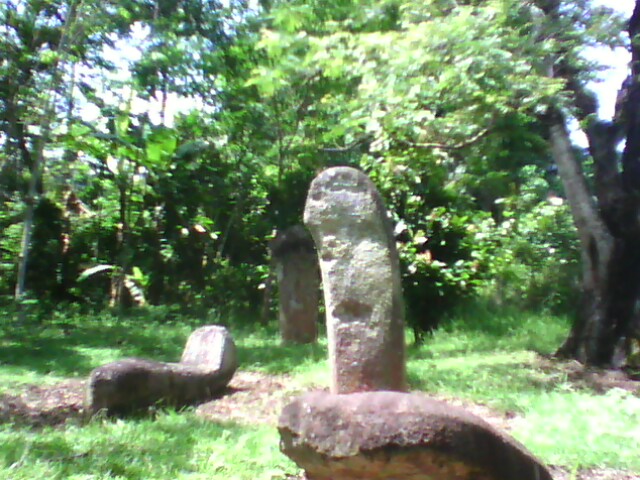
When you have arrived at Mahat Village, you will experience the mystical atmosphere of the location. Here, you can see various reliefs on some menhirs having various motifs such as swords, horns, and skulls. Such motifs are arranged neatly in such a manner shaping out the human statue without the body. In the past, it was used by animism believers as the medium for conducting worship. The menhirs here are beautifully carved, hence the location is a considerable tourism destination for you who are interested in archaeological study.
-

Beautiful Lake Maninjau : West Sumatra Destination
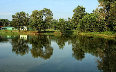
Lake Maninjau is a volcanic lake that is located at 461,50 meter above the sea level. Its width is 99, 5 km2 with 4, 95 meter of the maximum depth. The existence of Lake Maninjau has created a folktale called "Single Sembilan" (The nine Bachelors). People living around the lake believe that those nine Bachelors are real...
-

Bantimurung Waterfall the Best Destination in South Sulawesi
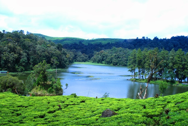
Bantimurung waterfall (15 meters in height and 20 meters wide) is a very famous natural tourism destination in South Sulawesi. Pure water falls down from the crag every year. Beneath the waterfall, there is a bathing place made of limestone covered by mineral vein which is caused by the stream flow for hundred years....
-

Nimanga River, Best Rafting in North Sulawesi
Nimanga River is one of the most favorite tourism destinations in the North Sulawesi. It has been popular as it is used for any kind of extreme sports and other activities. It will be great experience for having an extreme sport such as rafting along the river...
Saturday, December 21, 2002
Menhir in Mahat Village, West Sumatera
When you have arrived at Mahat Village, you will experience the mystical atmosphere of the location. Here, you can see various reliefs on some menhirs having various motifs such as swords, horns, and skulls. Such motifs are arranged neatly in such a manner shaping out the human statue without the body. In the past, it was used by animism believers as the medium for conducting worship. The menhirs here are beautifully carved, hence the location is a considerable tourism destination for you who are interested in archaeological study.
Tuesday, December 10, 2002
The Tirta Tapta Pemali Hot Spring
The water of the Tirta Tapta Pemali Hot Spring comes out of the land; it contains sulphur substance. It is also used for health therapy and relaxation for any kind of diseases. There was a Thai whose left hand was scratched as he was careless when operating a tin drilling rig in Bangka district. After being treated for several times, his injury got well, but he could not move his hand anymore. Until the day, he submerged into the Tirta Tapta Pemali Hot Spring for several times. His hand got better gradually. He had proven the efficacy of the Tirta Tapta Pemali Hot Spring as the right place for medical treatment.
Where access location the tirta tapta pemali hot spring?
The Tirta Tapta Pemali Hot Spring lies in Pemali village, Pemali sub-district, in the district of Bangka. It is around 20 km away from Sungailiat sub-district. The Tirta Tapta Pemali Hot Spring has been provided with hot water pool and rinse bathrooms.Some other facilities such as maxima stage, canal tourism, the family recreation park, the orchid flower park, and mini zoo, which has some new collections like crocodiles, bears, and birds. In addition, the collection of dot deer brought from the Indonesian Presidential Resident can be found there. You will also find a lake and plaza for fishing in the location. You will also find the only water boom in Bangka-Belitung province. For food and beverages, there are food tents and stalls around the family recreation park.
Friday, November 22, 2002
Cakalele Dance
Female dancers wear white dresses while holding handkerchiefs – in local language called lenso. During the performance, they play in groups consisting of two dancers while keeping dancing followed by the music of tifa (percussion), flute, and bia (flute made of big sea shell).
Tari Kebesaran, another name of Cakalele Dance is commonly performed to welcome honoured guests such as religious scholars, and government officials visiting Maluku. Tari Kebesaran means the pride dance.
Some of the distinctive features of the dance are the clothes, the swords, and the shield (salawaku). Each of them has its meaning such as red clothes symbolizing heroism, bravery and patriotism of Maluku people. Likewise, the swords symbolize the dignity of Maluku people that must be kept. The last one is the shield (salawaku), the symbol of protest againsts injustice government.
Cakalele Dance Location
Wednesday, November 13, 2002
The Uber Bay Beach
Besides its virginity, the Uber Bay Beach is a right place for escaping from the uproarious atmosphere of city life. It is proper destination to get your easeful holiday ever. At morning, when the sun is going to raise, the bright shinning sea reflecting turquoise water is the right time for visiting the destination. You will see some traditional fishers‘ boats which are drifted and buffeted above the sea surface. It is proper for you who want to enjoy your leisure time above the coastal rocks in the small huts made of woods while talking around the bush and jesting with family or friends.
Where The Uber Bay Beach Location?
Monday, October 21, 2002
Gedambaan Beach
Where Gedambaan Beach Location?
Tuesday, October 15, 2002
Limbungan Lake
Where Limbungan Lake Location?
Friday, September 27, 2002
Pekon Hujung Village
Since 2005, the village was planned as one of tourism destinations in Lampung Province. Thus, the local government refurbished the access to the location so that it can be accessed by car. Moreover, the local government also planned to build some guesthouses for visitors who want to take rest around the location for several days more.
“Rasakan Keaslian Hidup di Pekon Hujung” (Feel the nature living in Pekon Hujung) is the motto of the village. Its location in the slope of Mount Pesagi is the place where Kebut Pesagi celebration is held annually. Here, you can feel the tranquility of surrounding area which has fresh air and alluring nature.
Detail Location
Tuesday, September 17, 2002
Malimbu Hill
Malimbu Hill has a magnificent view where the panoramic scenery of its nature will enchant you while enjoying the sunset, Mount Agung in Bali and the range of Gili-gili (Small islands standing in a row in the north of Lombok Island). It will be very exciting for you who want to enjoy the beauty of Lombok Island especially at evening. The beauty of its nature and its precious scenery are ideal location for photographers to catch the photograph. Either local or foreign tourists come to the destination to catch the photographs of its beauty. It offers you various landscapes such as turquoise seawater, pounding waves, sunset, Green Mountain and a range of small islands. There are big trees inhabited by monkeys hanging around the location.
Where Malimbu Hill Location?
Tuesday, August 13, 2002
The Boulevard Area of Manado City
You will see various menus from not only Manado but also other provinces such as fried rice, Bakso (Meatball), Gado-Gado, Tinutuan, etc. The costs of those foods are cheap, so you may choose what you want. Café, restaurants, food tents and stalls can be easily found there. Besides enjoying its cuisines, you can watch the magnificent view of its nature and the beauty of Manado Tua Island. When the sun is going to set, you can watch the sunset with some new buildings that are being rapidly built in Manado city.
Where The Boulevard Area Manado City Location?
Thursday, August 8, 2002
Wooden House Craft Center in Minahasa
Dealing with the quality, people from other provinces such as Jakarta, Bali, and Java even foreign countries like Netherland and France, come to Minahasa for ordering such unique wooden house for bungalows or cottages.
The stock of the wood are brought from palu, Central Sulawesi and surrounding area in Southeast Sulawesi. The wooden house of Minahasa uses champac wood and maranti wood as the predominant material.
Woloan people greatly depend their life on the production of Minahasa wooden house. Besides, such skill in producing Minahasa wooden skill is a hereditary skill inherited from their parents. That is why, Woloan people are famous as the experts on building Minahasa wooden house.
The history of Woloan Village was started 150 years ago, in 1845 A.D. There were five prominent people who one of them was called Walian Pontoh (the leader of the village). He was also famous as an expert in healing diseases besides the leader of the village. Grappling with such matter, the word woloan was derived from walian, a customary title for people considered for having distinctive skills that was awarded to Walian Pontoh.
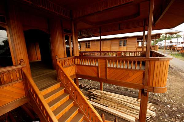
Wooden house made of Woloan people is totally unique considering its portabilty. There is nothing special with the ornaments on its parts. However, its capability to describe the typical architecture of Minahasa as well as stage house in Sumatra is a plus point.
While the other areas in North Sulawesi still depending their daily needs on the natural resources such as vanilla, nutmeg, clove and copra, Woloan people tend to utilize the wooden house craftworks as the primary matter for meeting daily needs.
You are not necessary to be afraid of how to bring the wooden house you have ordered. They have already provide delivery services for you ordering wooden house made of Woloan Village.
Nearby the location, northern direction of Woloan Village, you can see the beauty of Mount Lokon and Mount Merapi. Those are worth visiting tourism destinations located in Tomohon City. The atmosphere will be more splendid and fresher when you are arriving at the spring water around the location. Agricultural area in kakaskasen Village located in the slope of Mount Lokon offers you an unforgetable experience during the visit to wooden house craft center in Woloan Village and surrounding areas.
Detail Location
Tuesday, July 16, 2002
Bantimurung Waterfall the Best Destination in South Sulawesi
How to Access Go To Location?
Monday, July 15, 2002
Nimanga River, Best Rafting in North Sulawesi
- Nimanga River
Nimanga River is one of the most favorite tourism destinations in the North Sulawesi. It has been popular as it is used for any kind of extreme sports and other activities. It will be great experience for having an extreme sport such as rafting along the river. If you are not eager to do that, you may spend the night with friends or family in the campground by building tents while enjoying the beauty of its natural environment.
It is so wonderful to do some activities while enjoying the beauty of its nature. You will find two waterfalls located in two villages, Tincep village and Timbukar village. The waterfall located in Tincep village is 70 meters in height from earth surface while another one is about 90 meters from earth surface.
It will need approximately 5 to 6 hours to do rafting along the river. You will see some rare species such as Macaca Niagra (Monkey that can only be found in the North Sulawesi), Tarsius that is regarded as the smallest monkey in the world and many groups of birds. You may also observe the process of the traditional alcoholic drink fermentation that is well known as “Cap Tikus.” In the end of the trip passing the river, we will be offered with the beauty of National Sea Park while enjoying the attraction of Duyung Dugong in the middle of the thick mangrove forest.
Where location Nimanga River?
The Nimanga River can be found in the Timbukar village, in the district of Minahasa, North Sulawesi Province, Indonesia. To reach the destination, you can take any accessible public transportation for approximately three hours from Manado city.Tuesday, July 2, 2002
The Beautiful of Mahawu Mountain
Location Mahawu Mountain
Monday, June 10, 2002
Kasih Hill is The magnificent part of Kananong Village
Where Kananong Village Location?
Tuesday, June 4, 2002
Equator Monument
On March 2005, Badan Pengkajian dan Penerapan Teknologi – BPPT (the Center for Technological Application and Research) did a correction towards the appropriate zero point of the equator in Pontianak City. After a long-term research, the result shows that the zero point of equator crossing over Pontianak City is 117 meters of the former monument towards the Kapuas River.
Standing beneath the equator line precisely cleaving the earth is a memorable moment. In the location, you may see the former obelisk and its early history and all information relating to the monument as well. Withal, an information board about the statistic of visitors from either domestic or foreign countries is available for you who want to know such information. The unique of the monument is the material used. It was built of ulin wood, something that is rarely found on other monuments in the world.
Around March 21st – 23rd (vernal equinox) and September 21st – 23rd (auturnal equinox), the monument is densely visited by Pontianak residents who come to see the shadowless sun. It is the time when everything on the location around the zero point has no shadow for approximately 5 to 10 minutes. Some events including traditional ceremony and painting exhibition are celebrated during these phenomena are occurred. You only need to pay IDR 10.000 for obtaining a certificate signed by Local Mayor of Pontianak stating that you have already visited the monument.
At afternoon, the location can be a right place for having leisure time with family and friend. The exoticism of the location is at night when the flickering lamps decorating the beautiful Kapuas River.
Equator Monumen Location
Thursday, May 16, 2002
Situ Patengan
From the story above, there is belief that a couple who want to have an everlasting love, it is recommended to come to the lake and hang around Asmara Island and Batu Cinta (Stone of Love).
This 60 ha lake has magnificent view of surrounding area and green scenery of Rancabali tea farming land. Likewise, you will see pine forest in Patengan Natural Preservation that is still on its nature. You can rent speedboat, traditional boat, and other water transportation in the location to look around the beauty of the location. Moreover, fishing for people who love it is allowed. There is a right place for you who want to fish.
Around the location, some other small islands are available that are as beautiful as Situ Patengan. In common, local inhabitants function the lake for fishing. Moreover, it is also used as a proper place for camping.
Situ Patengan Location
Wednesday, May 8, 2002
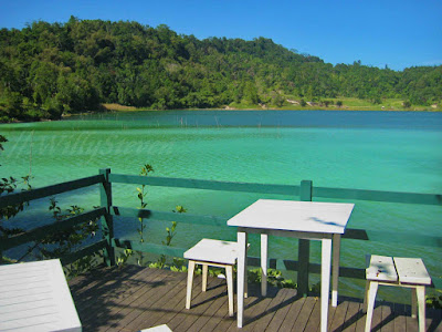
Lake Linow
How to Access Lake Linow Location?
Thursday, April 18, 2002
Mount Krakatau
Having a look around the mount from the peak is a memorable moment for you who love climbing. You will see the bluish scenery of Sunda Strait surrounding the mount. The emergence of Mount Anak Krakatau is an enticement for researchers to reveal the million mysteries of the mount containing so much mineral substances like volcanic bomb, lava, and lapilli overflow from the crater. It is the right place for having mountainous sports activities while enjoying the beauty of sea scenery around. Moreover, you may spend more nights at Sebuku Island or Sabesi Island.
Mount Krakatau Location
Monday, April 1, 2002
Lingsar Hindu Temple, Unique Pura in Lombok Island
How to Access Lingsar Hindu Template Location?
Monday, March 18, 2002
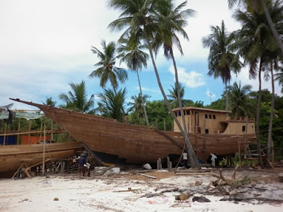
The Center of Perahu Pinisi Industry
How to Access Location
Wednesday, March 13, 2002
Cangkuang Temple
Cangkuang Temple was discovered firstly by Prof. Harsoyo and Drs. Uka Tjandrasasmita on December 19th , 1966. Both of them included into the researcher team of Leles history. It was discovered after receiving a report stated by Vordeman on the Notulen Bataviaasch Genootschap – published in 1893 A.D. – saying the existence of an ancient graveyard and the remain traces of Siwa Statue in Leles. Some other pre-historic age legacies were discovered on the next research. They were kendan stones (oxidant stone), pieces of earthenwares from the neolithic age and big stones from the megalithic age.
Having a look at the shape of the temple, some archaeologists assumed that the temple was erected in the eighth century. However, from the simple ornaments used, the making technique, and a chinese record, there is a prediction that the temple was built in the seventh century, on the same era as the building of Javanese temples.
Along the journey to the location, you will ride by Pulo Village which has the unique tradition and well-preserved traditional houses. By taking getek – raft made of bamboo – you will see the panoramic sight of Cangkuang temple that is awesome.
The atmosphere in Panjang Island, the location of Cangkuang Temple, is quite fresh and has imposing view because there is a beautiful park and the number of teureup tree, banyan trees, and randu tree (Ceiba pentandra). Moreover, the existence of Mount Haruman, Mount Mandalawangi, and Mount Guntur combined with the calm water of surrounding area can enhance the location as the worth visiting tourism destination for you.
A public small museum keeping many antique objects and 12 ancient books is located nearby the temple. Some documents telling the history and all information relating to the temple can also be found in the museum.
About a kilometer away from the museum, there is a tomb of Embah Dalem Arif Muhammad. It is believed that he was the envoy of Mataram Kingdom who was assigned to fight againts VOC in Batavia (Jakarta). After being defeated by VOC, he and his entourage decided to keep staying in Cangkuang where the local inhabitants there had embraced Hindu. Considering such reality, the location is a right place for cultural and natural tourism.
Cangkuang Temple Location
Thursday, March 7, 2002
Bledug Kuwu
Since the reign of old Mataram Kingdom (732 – 928 A.D.), bledug kuwu has been shaped out naturally from the volcanic mud in the district of Grobogan, Central Java, Indonesia. Over and above the existence of eternal fire resources of Mrapen and Kedungombo dam, Bledug Kuwu is the worth visiting tourism destination in Grobogan District, Central Java Province. Bledug Kuwu is derived from Javanese language, bledug means explotion/ to explode and kuwu/ kuwur means run or scattered about.
The early history of bledug kuwu was started when a man namely Joko Linglung was going home from the Pacific Ocean to Medang Kamulan Kingdom through a hole – that is now bledug kuwu – after defeating Prabu Dewata Cengkar. Joko Linglung made the hole himself as he was able to transform into a snake. Such ability was a requirement to be admitted as the son of Aji Saka, the roler of Medang Kamulan Kingdom.
Along the journey to bledug kuwu, you will see the natural view of thick forest, green farms, and beautiful hilly areas. In the location, you will see frequent small explotions of the mud every two to three minutes. The wallow mud area is 650 meters in diameter. Sometimes, the mud`s explotions can be as high as local inhabitants` houses.
The existence of bledug kuwu is utilized by local inhabitants for livehood resources by producing salt. The activity of local people in producing salt in the location is a distinction which is rarely found in the mainland. The expertise of local people in producing salt was recorded on the history of Surakarta Kingdom.
Bledug Kuwu Location
Tuesday, February 26, 2002
Jatijajar Cave
The entire length of the cave is 250 meters, scattering from the entrance door to the way out. Not only that, the cave is 12 meters high, 15 meters square of width,10 meters of the canopy and situated at an altitude of 50 meters.
It was Suparjo Rustam – the Governor of Central Java - who had an idea to develop Jatijajar Cave as a valuable tourism destination in 1975. The building process was conducted by CV. AIS, Yogyakarta, headed by Saptoto, a famous dioramic expert coming from Yogyakarta. After that, the further management was taken over by the local government of Kebumen.
A spurting-water dinosaur statue, in front of the cave, symbolizes the urgency of the cave. People entering the location will pass by the mouth of the statue. The spurting-water from the statue‘s mouth comes from the Kantil River and the Mawar River. It is believed that the water never dries up even in drought season. Often, the water is utilized for irrigating the people‘s farms.
Exploring into the cave, you will see the wondrous scenery of surrounding area. Flickering lamps lightening the entrance door to the way out, enhance the comfort of your visit. Thus you are not necessary to be afraid of the illumination inside the cave. Some holes on the wall of the cave function as ventilation so that the air circulation within the cave keep on stable. In the center of the cave, there is a circle stone for your seat when you are tired, so you can keep enjoying the beauty of the cave.
About eight dioramas with 32 effigies depicting the story of Raden Kamandaka (commonly known as the story of Lutung Kasarung) – the son of Padjajaran King – who lived as an ascetic in the cave looking for divine inspiration, can be watch therein. He lived as an ascetic in Jatijajar Cave because the location, at the time, included into the territory of Padjajaran Kingdom (now West Java) with Bogor (cited in Batutulis inscription) as the capital.
While the entrace door to the cave is the mouth of dinosaur statue, the way out of the cave is the tail of the statue. The distinction of the cave from other caves in Indonesia is the existence of four underground rivers (seven in other sources) listed below: the Mawar River, the kantil River, the Jombor River, and the Puser Bumi River. The Mawar River and the Kantil River flow through narrow fissures penetrating the wall to the way out. By washing our face by the water of the Mawat River, it is assumed for being able to make us stay young. And, washing our face by the water of the Kantil River can make our dreams come true. The last two underground rivers, the Puser Bumi River and the Jombor River are intentionally considered as sacred by the management of the cave. People who want ot explore those two underground rivers must have permission from the management first.

